


"Change configuration" tool
The Change configuration tool is provided to specify default parameters.
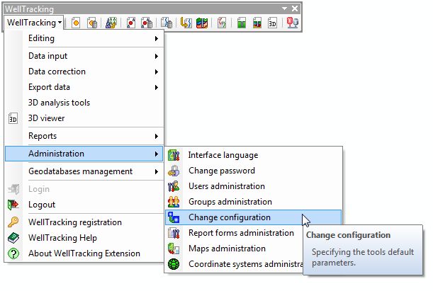
Select Administration in the WellTracking menu and point to Change configuration.
Edit fields in the next dialog, where appropriate.
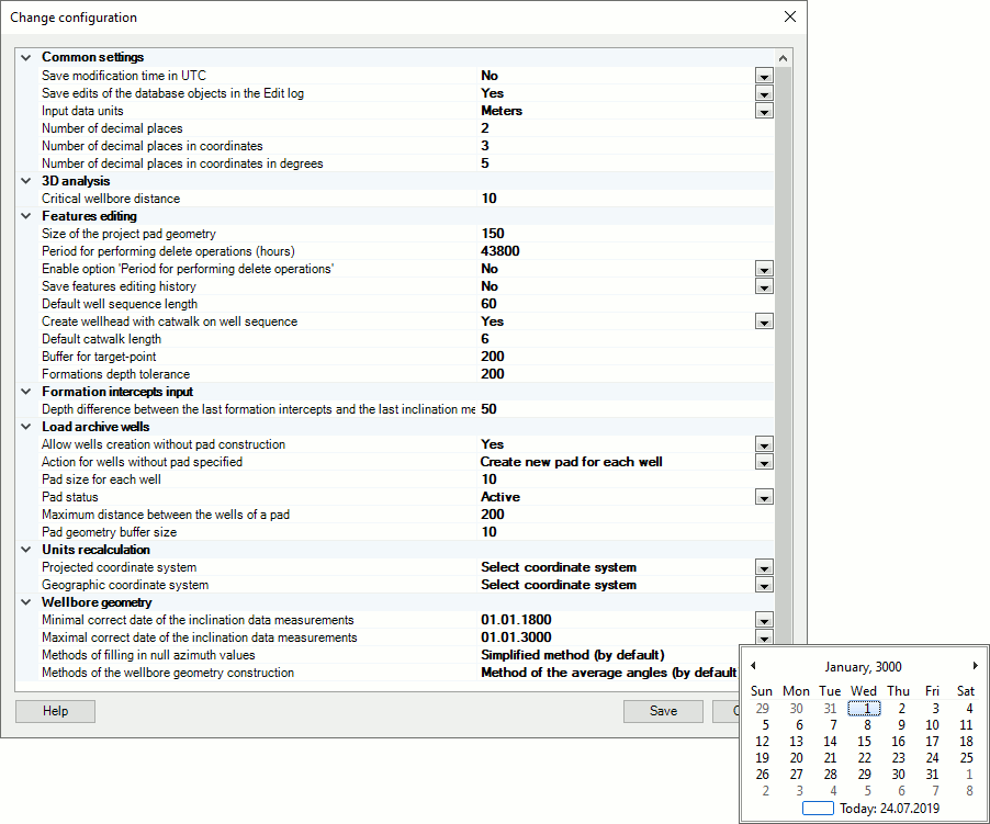
COMMON SETTINGS
- Save edits of the database objects in the Edit log: this parameter is valid for those users working with the WellTracking geodatabase replicator.
- Save modification time in UTC: this parameter allows saving the feature modification time, which will be stored in the appropriate column of the attribute table.
- Save edits of the database objects in the Edit log - The Edit log consists of three tables: REPL_CHANGE_LOG, REPL_LINK_CHANGES and REPL_LINKS. All edits (creation, update, deletion) are recorded to the log to be further used for synchronization of the WellTracking databases.
- Input data units - meters, feet.
- Number of decimal places - setting calculation results for 3D analyses tools, distance between target-points in the Create target-point tool, etc.
- Number of decimal places in coordinates - setting calculation results for 3D analysis tools, XY coordinates for target-points obtained by clicking on the map, etc.
Note! Setting coordinates’ precision in Reports group is done in the Reports tools dialogs directly.
3D ANALYSIS TOOLS
- Critical wellbore distance, m: The tool is provided to find any intersection of wellbores of one well and to calculate critical distance between these wellbores. The default distance is 10 m (see Critical distance tool section).
FEATURES EDITING
-
Size of the project pad geometry, m - This parameter will further be the default parameter for creating pad areas using the Edit pad - Create pad tool. With this parameter the square size of the project geometry of the pad is specified. Default side size is 150 m.
-
Period for performing delete operations (hours)- this is the period of time when the incorrectly created object can be deleted by the operator. After this period is expired, the delete operations can be performed by the system administrator only. The default period is one hour from the moment of the object's creation.
-
Enable option 'Period for performing delete operations' - choose Yes or No from the list.
-
Default well sequence length – this parameter is specified as 0.40 multiplied by value of the square side of the pad project geometry. The parameter is used for work with the Create well sequence tool.
-
Create catwalk when creating wellhead on wellrow – default parameter specified in the Catwalk geometry dialog of the Wellhead creation tool.
-
Default catwalk length – this parameter is specified as 0.10 multiplied by the wellrow length. The parameter is used for work with the Create well sequence tool.
-
Buffer for target-point – this is the buffer zone around the project wellbore and the related target-points. This parameter (the default value is 200 m) is used for work with the Create target-point and the Update target-point tools.
-
Formation depth tolerance – this parameter means the buffer zone size for formation used for editing the formation depth value when creating or updating the target-point location. The default parameter value is 200 m.
FORMATION INTERCEPTS INPUT
- Depth difference between the last formation intercepts and the last inclination measurement point. The default difference value is 50 m (see Formation intercepts input tool section).
LOAD ARCHIVE WELLS
-
Actions for wells without pad specified – select the action from the list: Skip wells, Create new pad for each well, Combine near wells in a new pad.
-
Pad size for each well – the default parameter value is a square with the side of 10 m.
-
Pad status – the list of the pad area statuses is created based on the following domain values: Project, In the process of drilling, Active, Abandoned, unknown (see WellTracking geodatabase scheme).
-
Maximum distance between the wells of a pad – the default value of this parameter is specified as 50 m.
-
Pad geometry buffer size – the default value is 10 m.
UNITS RECALCULATION This is a mandatory parameter!
-
This parameter is provided to prevent errors related to converting data from one coordinate system to another (for example, when your data are stored in the geodatabase of one system coordinate, but the map is created using the other coordinate system). The tool is applicable for work with the Reports, Formation intercepts data input, and etc. tool groups.
-
The Projected and Geographic coordinate systems are added to the WellTracking geodatabase using the Coordinate systems administration tool of the Administration tool group.
WELLBORE GEOMETRY
-
Minimal and Maximal correct date of the inclination data measurements - With this parameter the latest dates of adding inclination data are specified (see Inclination data input and Inclination data journal sections).
- Methods of filling in null azimuth values - Sometimes the part of the Azimuth column is filled in with the null values. In these cases WellTracking provides two options of specifying such intervals: Simplified method (by default), Advanced method. For more information see the Inclination data input tool section.
- Methods of the wellbore geometry construction: WellTracking has three different methods of the path construction: Method of the average angles (by default), Method of the curvature radius calculation and Balance tangential method.
To save input parameters click Save.
To exit the dialog click Close.
*****