


"Create target-point" tool
This tool allows creating the project point of the bottomhole. There are following options provided in the WellTracking geodatabase structure:
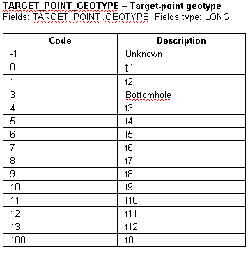
- 11 project target-points to create project vertical, deviated and horizontal wellbores.
- 1 bottomhole point. The information about target-point with the Bottomhole geotype can be obtained after drilling only, and this point is created automatically along with the formation intercepts input.
- 1 target-point with the Unknown geotype.
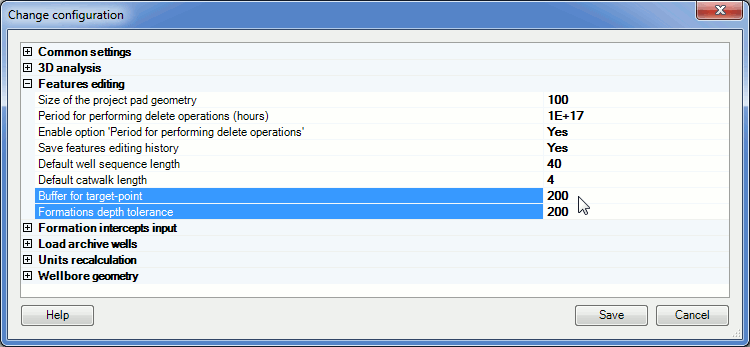
Besides, the tool allows numbering of the pilot and the emergency wellbores that can be created along with the creation of the project target-point. The size of the buffer zone around the target-point and the project wellbore is specified in the Administration>Change configuration>Features editing. The default buffer zone value is 200 m.
For the created target-point there is an option to create the buffer zone around the project wellbore and to specify the appropriate restrictions for the formation depths.
By creation of the target-point the user specifies the formation and its depth. The critical formation depth tolerance value stored in the WellTracking database formations library is also specified in the Administration>Change configuration>Features editing. The default formation depth tolerance is 200 m.
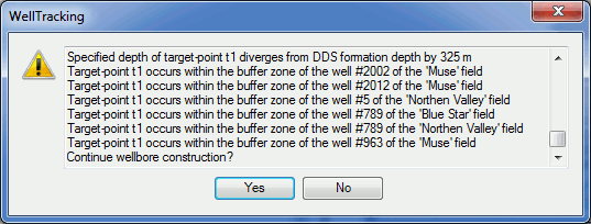
All input parameters are verified and in case of any errors the system returns the appropriate warning message with the list of the target-points and the variation values (see Step 3. Create target-points).
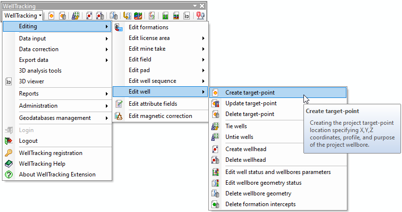
To create a new target-point in the database select Edit well in the WellTracking menu and point to Create target-point.
The following steps should be performed to create the new target-point:
Step 1. Specify well parameters
Step 2. Specify wellbore parameters
Step 3. Target-points editig
Step 4. Edit user attributes of the target-point
Step 5. Summary info
*****