


"Inclination data input" tool
Inclination data allow managing the spatial location of the well axis.
Click here to learn more about data formats used in WellTracking.
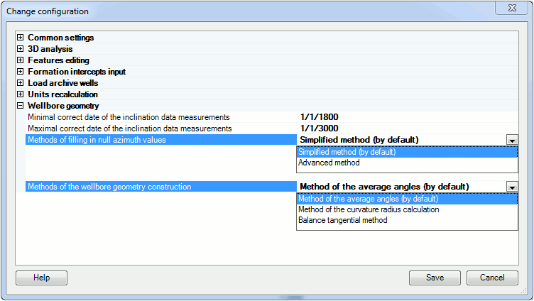
The following data is used to build the wellbore geometry in WellTracking: drilled depth, zenith angle, magnetic azimuth, magnetic correction and meridian convergence. Sometimes the part of the Azimuth column is filled in with the null values. In these cases WellTracking provides two options of specifying such intervals:
The default method of processing the inclination data is the Average angles method. However you can select other methods, for example, the Method of the curvature radius calculation or the Balance tangential method.
The appropriate options are specified in the Administration > Change configuration > Wellbore geometry.
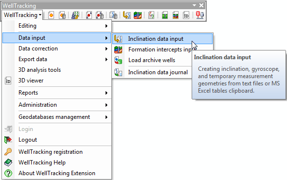
Select Data input in the WellTracking drop-down menu and point to Inclination data input.
The inclination data input for wells with the wellhead is performed in some steps:
Step 1. Select file to be processed
Step 2. Inclination data
Step 3. View input inclination data
Step 4. Check summary data and start data processing
After input of the wellbore geometry the appropriate records appear in the following tables: WELLBORE_GEOMETRY, INCLINATON_DATA_JOURNAL, INCLINATION_DATA_READINGS.
The Inclination data input tool automatically modifies the wellbore geometry status:
- Inclination data, gyroscope: the well status is modified to Active, the wellbore status is Active.
- Temporary data: the well status for the first wellbore is modified to In the process of drilling, for the rest of the wellbores the well status remains the same, the wellbore status is In the process of drilling.
The inclination data and other wellbore geometries can be deleted using the "Delete wellbore geometry" tool.
*****