


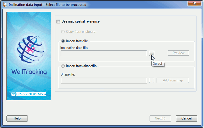
Step 1. Select file to be processed
The inclination data input can be performed by using 3 methods:
-
Importing from the text file;
-
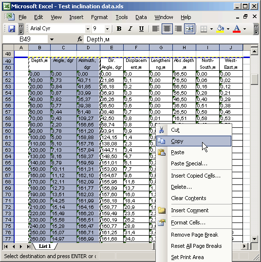
Copying data from the *.xls/xlsx table;
-
Importing from the shapefile.
-
In order to copy data from clipboard following steps should be performed:
1. In the *.xls table containing the inclination data select the required fields (Depth, Angle, Azimuth) and copy them to clipboard.
2. The Copy from clipboard option of the Inclination data input dialog becomes active.
-
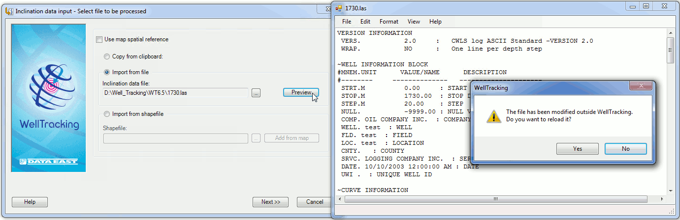
By selecting the Import from file option, specify the required file with the inclination data. This can be text data of *.inc, *.lst, *.txt and *.las formats (to learn more click here ). The View option allows viewing and data editing in all files in Notepad.
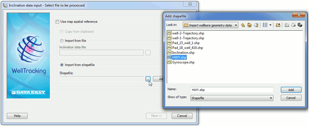
- The Import from shapefile option is provided to import wellbore geometry obtained as a result of processing measurement data to the WellTracking database. Such processing can be done using different software, for example, Petrel.
Press Select button to open the Add shapefile dialog with list of shapefiles located on your computer or in the network.
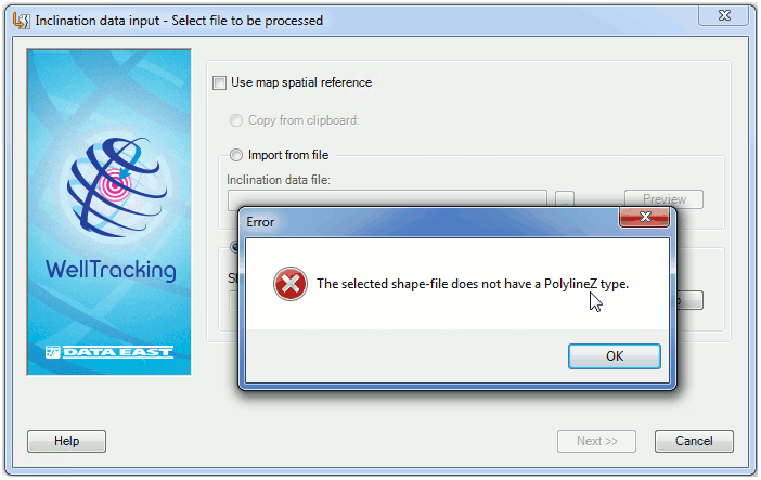
In case of entering incorrect data the following warning message appears.
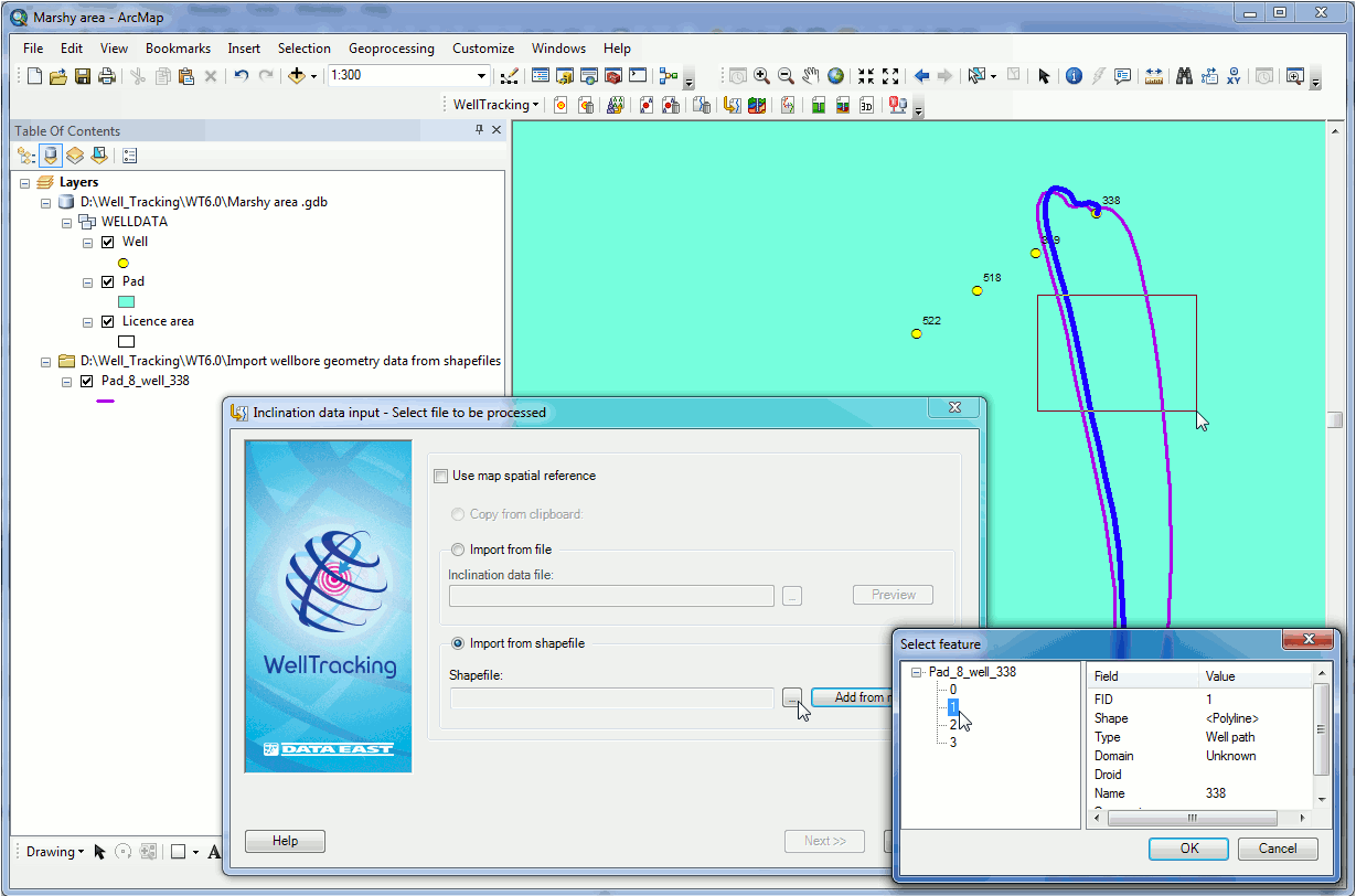
If selected shapefile contains more than one record in its attribute .dbf table, i.e. more than one measurement for one wellhead, you will be suggested to select the required wellbore measurement by its unique value shown in the FID field of the Select feature double table. Select FID of the measurement from the list located in the left part of the Select feature double table and the list of respective attributes will be shown in the right part of the table and selected measurement will be marked blue on the map preview window.
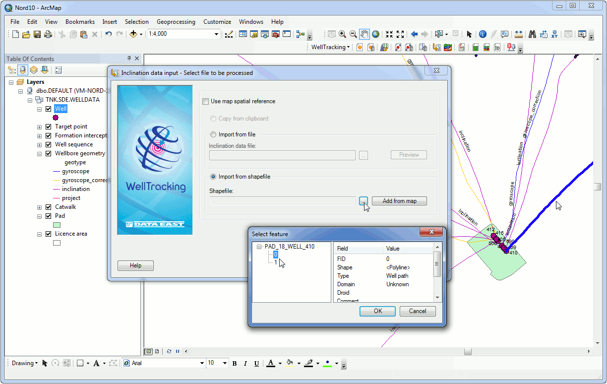
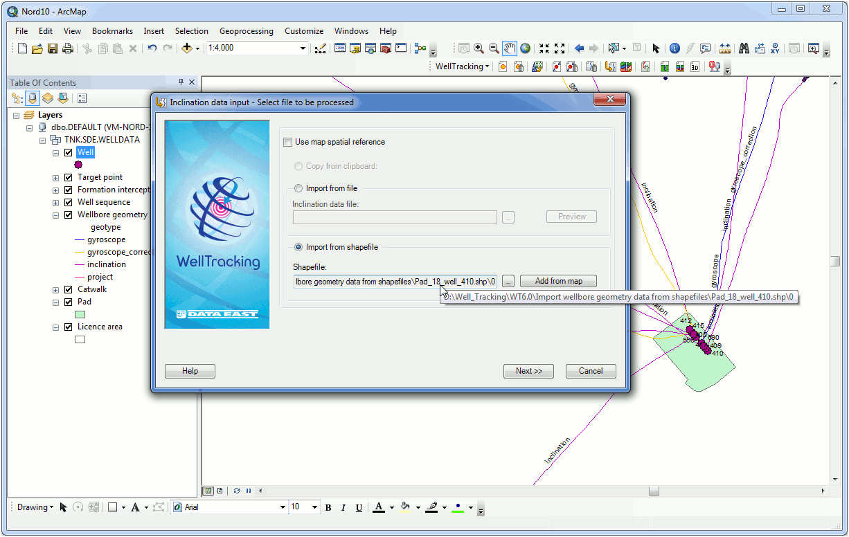
Select the measurement and close the Select feature dialog by pressing ОК. The selected shapefile location, its name and FID of the selected measurement will be shown in the dialog.
If your map contains wellbore geometries in shape format that need to be imported to the WellTracking geodatabase, use the Add from map option for this operation.
Fill in the remaining fields of the dialog and press Next.
Click Cancel to close the dialog.
*****