


Step 4. Create pad geometry
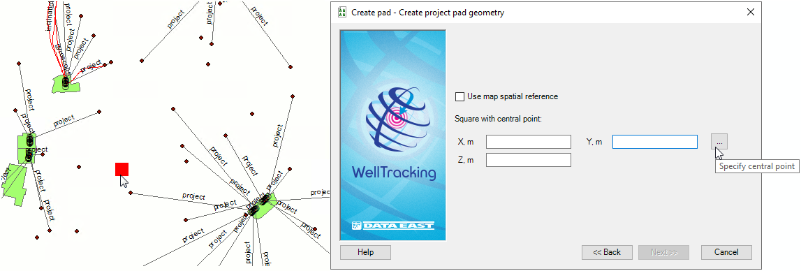
At this step you need to specify the method of creating the project pad geometry. The default project pad geometry is a square with the central point specified by the user.
The length of the square side is set by the Administrator and stored in the extension properties (see Administration section, Change configuration).
The Use map spatial reference option is provided to enter map coordinates, which can differ from the database coordinates. If this option is not checked the feature coordinates will be automatically projected to the database coordinates.
To create project pad geometry press Specify central point button and then point the expected pad center on the map. The X , Y fields are populated with the coordinate values of the square center. The Z, m field (the pad altitude) is fill in by user manually.
Press Next to move to the next step of creating the pad
Press Back to get back to the previous step and Cancel to exit the Create pad tool dialog.
*****