Interactive map
Interactive map is an interactive display of geographic information that you can use to tell stories and answer questions. Being a set of web-services, user settings and authorization rules, interactive maps allow solving various specific GIS-tasks: either spatial data management and editing, or metadata representation on the map, or transportation and logistics data management, etc.
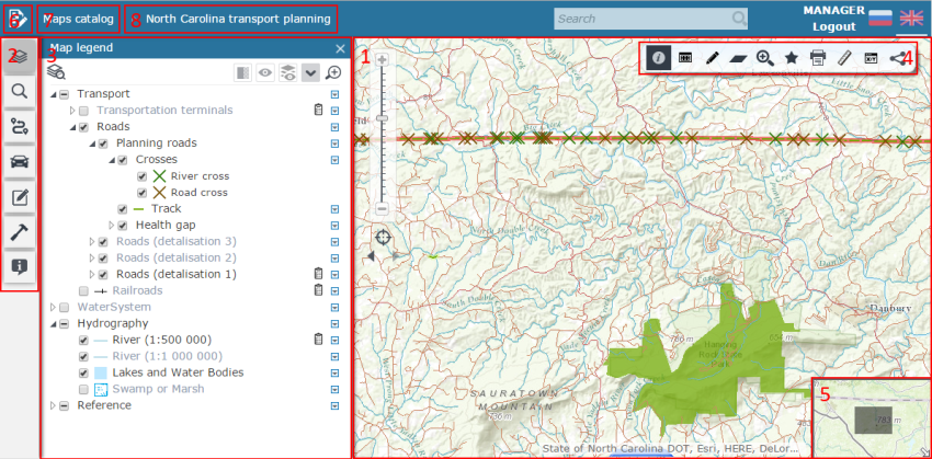
The interactive map interface consists of the following components:
1 Map display area
2 Functionality tabs:
3 Display area of the functionality tabs tools
4 Toolbar
5 Map overview window
6 Go to map constructor and interacative map editing button
7 Go to interactive maps catalog button
8 Map applications list
9 Language settings manager.