


About Reports tools
There are ten types of reports to be used at any stage of the survey works provided in WellTracking:
- Source well drilling data report has all necessary information for drilling wells;
- Project data for well sequence drilling report contains coordinates of project wellheads in the well sequence;
- Preliminary pad data report is provided to determine the pad area drilling order.
-
Well coordinates report contains coordinates of project wells;
- Wellhead coordinates report shows wellheads’ coordinates of drilled wells;
- Formation intercepts report contains coordinates of bottomholes, intersection point of wellbore with formation bottom and Intersection point of wellbore with formation top;
- Catalogue of the source points coordinates report contains information about pads of the selected field, X, Y - coordinates of the first wellhead in the well sequence and directional angle of direction of skidding the rig.
- General field data report contains statistics about quantity of pad areas, wells, wellbore geotypes, drilling depths, etc. of the specified field.
- Wellbore geometry report contains calculated parameters of wellbore geometries, including the project design-plan.
- The ‘Export to geological packages’ report contains data for export to software package RN-KIN of Rosneft company. The report can be generated in two forms. The first form contains data about all formation intersection points, whereas the second one – only formation well tops data.
The reports are generated based on the *.dot (MS Word) and *.xlt (MS Excel) templates.
This will allow the user to obtain ready report in *.doc or *.xls formats, correspondingly.
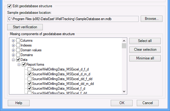
To add report templates automatically use the 'Edit geodatabase structure' tool. Mark the report templates you want to download and after operation is completed the selected templates will appear in your GDB.
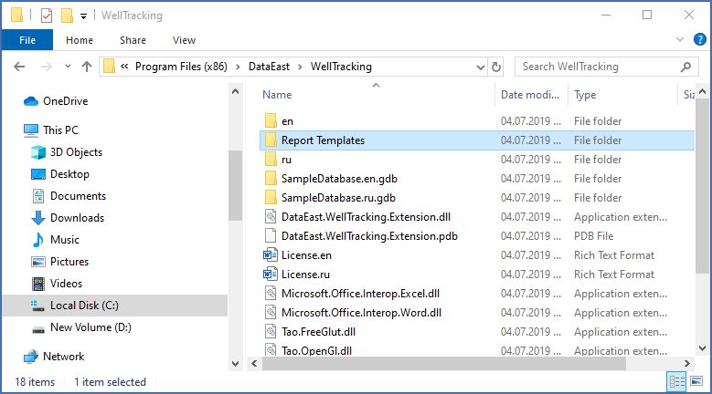
All report forms templates are located in the WellTracking installation package. You can find the list of available templates in the Report_Templates folder after the WellTracking installation.
Setting custom reports properties is done in Administration > Report forms administration tool .
Coordinates of wellheads, formation interceptss and etc. for the output reports are obtained from the coordinate systems information, added by the user to the WellTracking geodatabase.
The coordinate system properties are specified in Administration > Coordinate systems administration tool .
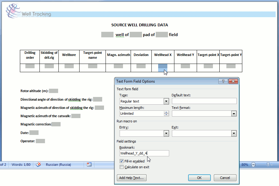
By default the coordinates precision in *.xlt templates is of three decimal places and is set in the cell format.
The coordinate precision in *.dot templates is set in Field Settings>Bookmark, where:
• dd – decimal degrees, n – number of decimal places
• d - degrees, n – number of places in seconds
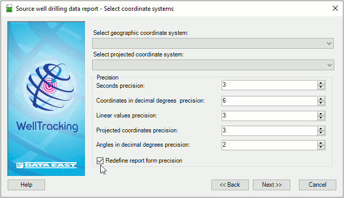
For users’ convenience there is an option of setting coordinates precision for all report types.
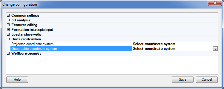
If your data is in geographic coordinate system (a map or WELLDATA feature dataset), the following parameters should be set to avoid data corruption:
• In Administration > Coordinate systems administration specify the coordinate system compatible with your geodatabase coordinate system;
• In Administration > Change configuration specify the measurement units recalculation parameters and coordinate systems set in the Coordinate systems administration dialog.
******