


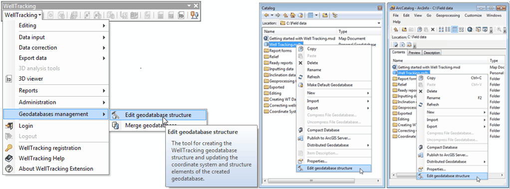
Creating database using the "Edit geodatabase structure" tool
The tool is provided to create and update the WellTracking database schema. With the Edit geodatabase structure tool the user can create feature classes (LICENSE AREA, MINE_TAKE, PAD, WELL, TARGET POINT, FORMATION INTERCEPTS, WELLBORE GEOMETRY, CATWALK, WELL SEQUENCE), FORMATION, FIELD and WELLBORE tables, feature classes attribute tables as well as specify relates between tables in order to provide integrity of data to be further used by the WellTracking extension.
With the Edit geodatabase structure tool you will be able to update structure of geodatabases created using WellTracking 6.5 and below.
With this tool you will be able to not only update the structure of the geodatabases created in WellTracking below 6.5, but also to automatically upload various user templates for all types of reports, and to reproject the existent data in case if the coordinate domains of the source and the modified coordinate systems do not conflict with each other.
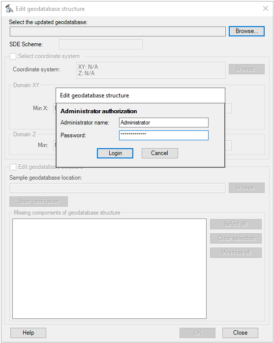
Note that only WellTracking system administrator can edit geodatabase structure.
The tool is run both from the main WellTracking menu and in Catalog and ArcCatalog from the context menu of the selected database.
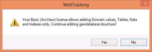
Note: setting the tables relationships and new fields are available with ArcEditor and ArcInfo only . If you have ArcView license, address to technical support at support@dataeast.com with the request to create the WellTracking database individually. Or you can use SampleDatabase.en.gdb from WellTracking installation folder.
WellTracking works with all types of databases: *.mdb (Personal Geodatabase), *.fgdb (File Geodatabase) and SDE.
Note: working with the corporate SDE databases is available with ArcEditor and ArcInfo only.
Two options are available for working with the tool:
1. Create empty WellTracking GDB with the predefined structure;
2. Renew current GDB created with WellTracking versions below 6.5.
1. To create the structured WellTracking geodatabase it is required to:
-
Specify the scheme for this geodatabase using the Edit geodatabase structure tool.
-
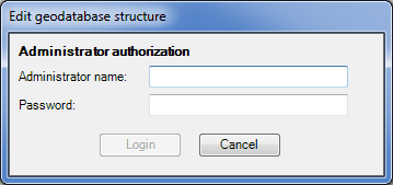
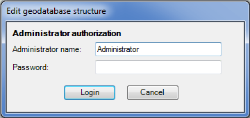
The first authorization is done by the system administrator under the Administrator name without entering the password.
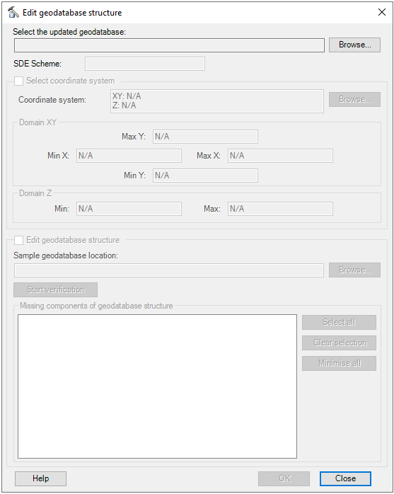
Run the Edit geodatabase structure tool from the WellTracking main menu, then fill in the following dialog.
-
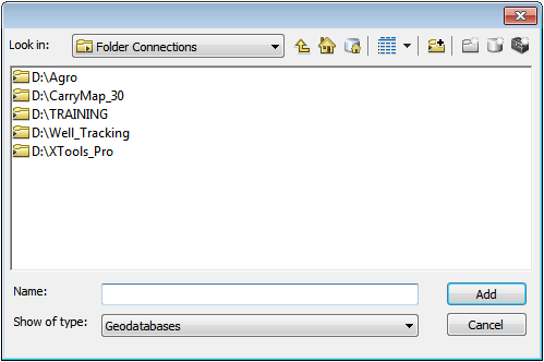
Select the updated database: specify location of the empty geodatabase you just created in ArcCatalog..
-
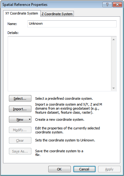
Specify the coordinate systems using the standard set of ArcGIS *.prj files or specify the path to your own text files containing the required projections data.
- The Sample geodatabase location field is filled in automatically. The sample geodatabase is located in the installation folder; its structure is predefined and is used as a geodatabase template.
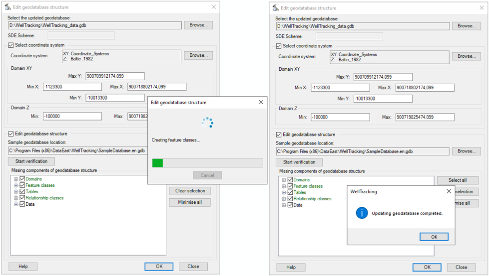
- The Start verification option runs the comparison of the specified geodatabase with the sample geodatabase and shows the list of missing elements as the comparison result.
To start creation/update of the WellTracking geodatabase press OK. The following message appears after the process is completed.
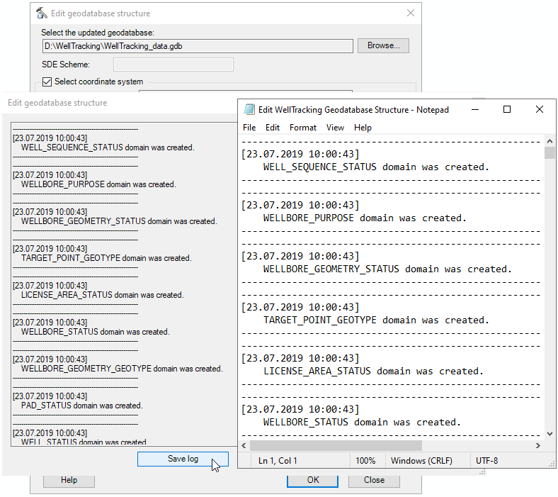
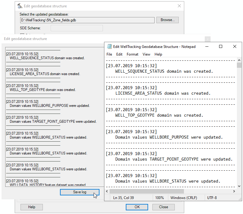
After the geodatabase has been created, you can review the list of the created tables and the relations established between them in the Log output dialog. The text of the log-file can be saved to the hard disk if required.
Click Close to exit the Edit geodatabase structure tool dialog.
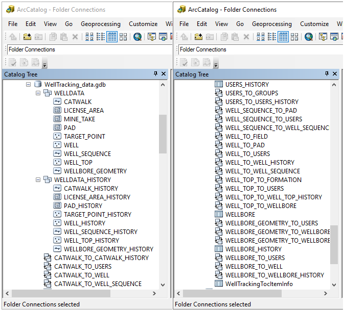
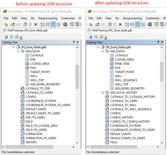
After Edit geodatabase structure tool has finished working, the structured geodatabase in ArcCatalog should look as following:
2. Renew current GDB created with WellTracking versions below 6.0.
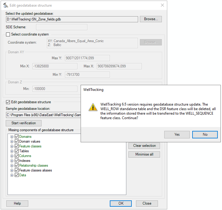
As WellTracking 6.0 supports both stationary and mobile drilling, the geodatabase structure for work with well sequence has been updated respectively. In versions below 6.0 the well row WELL_ROW had no geometry and was a standalone table, with that the DSR and Catwalk feature classes were related. Whereas in WellTracking 6.0 the WELL_SEQUENCE is a spatial feature related with catwalks and wellheads. So, to work with new WellTracking 6.0 you need to update the geodatabase structure.
Note that if geodatabase structure is not updated, you will not be able to login to the WellTracking system.
How it works
1. DSR feature class and WELL_ROW table as well as all their relationships will be deleted.
2. In the WELLDATA feature dataset the new WELL_SEQUENCE feature class will be added.
3. Service fields from DSR attribute table and WELL_ROW standalone table will be transferred to the updated WELL_SEQUENCE attribute table. The respective domains and relationship classes will be created.
4. User fields from DSR attribute table and WELL_ROW standalone table will be added to WELL_SEQUENCE attribute table.
5. Structure elements marked green are mandatory and so cannot be edited by the user.
Select geodatabase and login.
Fill the dialog and start processing..
After the geodatabase has been created, you can review the list of the created tables and the relations established between them in the Log output dialog. The text of the log-file can be saved to the hard disk if required.
Example of GDB structure renewal with the Edit geodatabase structure tool is shown below.
*****