


About "Display WellTracking layer settings" tools
If you need to make a presentation or to create a map to show some specific objects of your geodatabase, you can use the WellTracking display layer settings tool group. This tool group can be run from the data frame context menu, or from the group layer context menu, or from the context menu of the active layer.
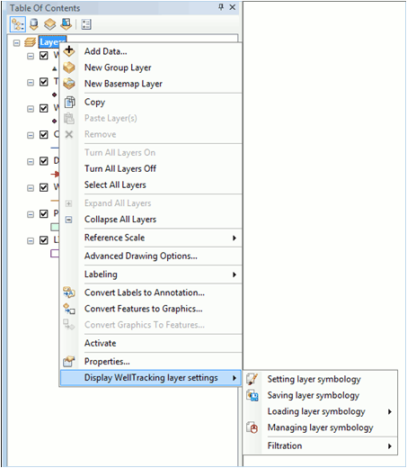
The group consists of the following tools:
• Setting layer symbology – specifies symbology properties for all features of the selected layer by related layers;
• Saving layer symbology – saves information about symbology and labeling properties for the selected layer;
• Loading layer symbology – displays the selected layer using the previously saved symbology;
• Managing layer symbology – renames and deletes created symbologies;
• Filtration – specifies the data to be shown on the map;
The tools of this group become enabled after WellTracking system login only.
*****