


''Filtration" group tools
The Filtration group consists of Filtering data to presentation and Clear filters tools.
Filtering data to presentation
The tool is provided for setting the map data display properties. As a result of the tool work the features that meet specified settings will be displayed on the map.
This tool can be run after WellTracking system login from the context menu of tables, layers, group layers, and data frame.
The example of work of the Filtering data to presentation tool is shown below. In the TOC two layers are selected to be displayed on the map.
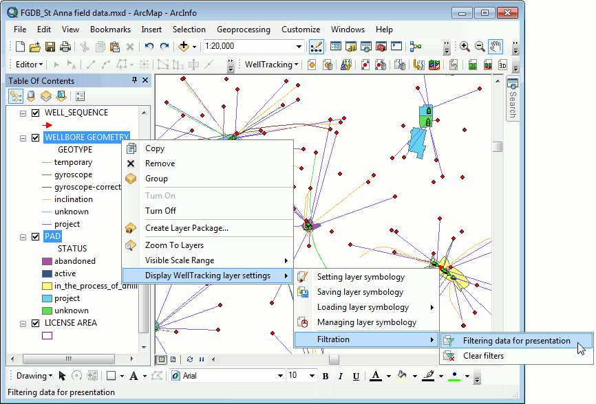
The tool allows filtering data by parents (Fields, License areas, Formations), and by domains.
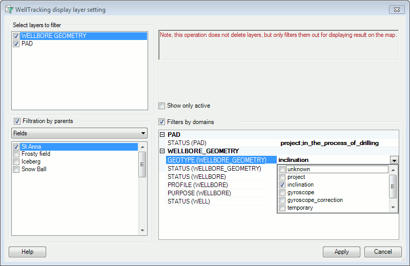
As a result only wellbore geometries with inclination geotype and pad areas with in_the_process_of_drilling status are displayed on the map.
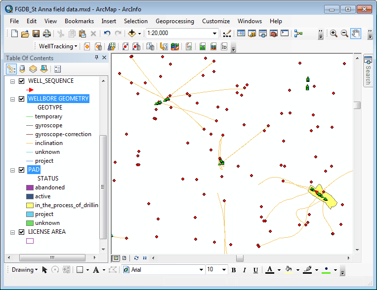
Press Filtration > Clear filters to get back to the previous map view, if required.
*****