


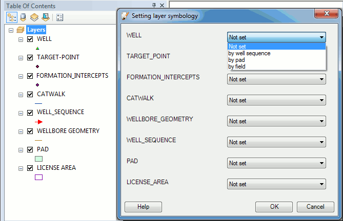
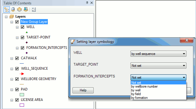
"Setting layer symbology" tool
This tool is provided for setting features symbology of the active layer using the data from Status and Geotype columns of their attribute tables, and using the symbology properties of the related feature classes.
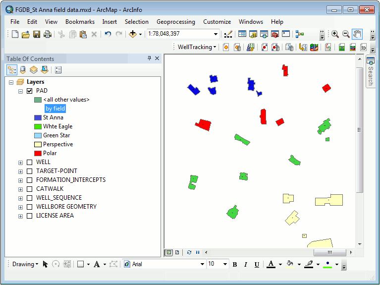
• For WELL layer the symbology by formations, well sequences, pads, fields is used;
• For TARGET_POINT layer the symbology by fields, well sequences, wellbore, pad, and field is used;
• For FORMATION_INTERCEPTS layer the symbology by wellbore number, well, field, formation is used;
• For WELL_SEQUENCE layer the symbology catwalk, pad is used;
• For CATWALK layer the symbology by well sequence, pad, field is used;
• For WELLBORE_GEOMETRY layer the symbology by wellbore, pad, field, geotype and status, and formation is used;
• For PAD layer the symbology by field, formation, status field is used;
• For LICENCE_AREA the symbology by geotype field is used.
The tool is run from the context menu of the data frame, group layer, and active layer > WellTracking display layer setting.
The tool is enabled after WellTracking system login only.
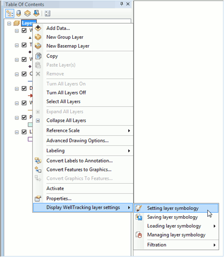
• If you need to display features of several layers of your map simultaneously, run the tool from the data frame context menu and select the required layers from the list.
• If you need to display the group layer, you can specify its symbology in the dialog containing the list of layers included to the group.
• If you need to set symbology for the active layer, run the Setting layer symbology tool and select the required layer from the list.
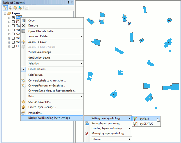
The result of the tool work is shown below:
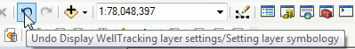
Press Undo button on the ArcMap toolbar to cancel the specified symbology properties settings.
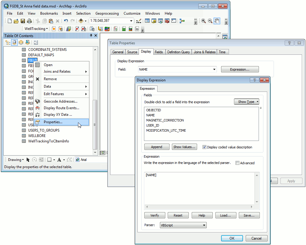
Briefly about the process of setting layer symbology.
After you run the Setting layer symbology tool, the required tables are joined and the layer symbology is created based on the specified field.
There are two variants of setting layer symbology.
1. Setting symbology based on the specified feature class, by the Field feature class, for example.
If your map contains the Field layer, the name of each symbol will be generated using the expression DisplayExpression (which is specified in the layer properties dialog FeatureLayer (StandaloneTable) ->Properties -> Display->Display Expression). If you specified to take the symbology name from the Name field, the tool will join necessary tables and will display your Field layer features based on the symbology of the features from the Name field.
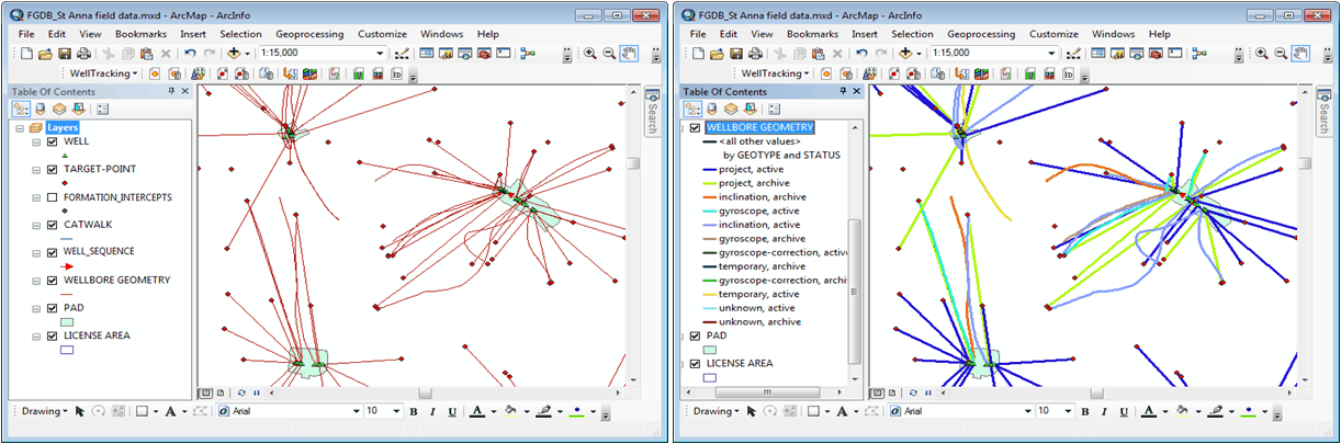
2. Setting symbology based on the specified fields, for example, for Wellbore geometry layer the symbology of the Geotype and Status fields can be used. In this case the necessary tables will be joined and the layer features will be displayed using the correspondent values from the Geotype and Status fields.
*****