


"Wells correction" tool
The Wells correction tool is provided to update the project wellheads and their catwalks locations based on the field data. Data can be in any ArcGIS supported format and as *.xls tables (see How to work with *.xls tables using Wells correction tool section).
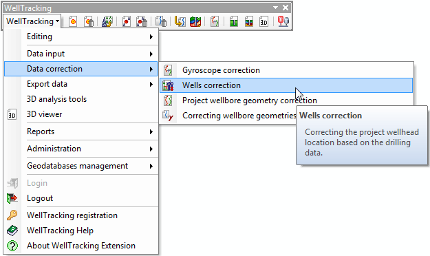
To correct well data point to Data correction in the WellTracking menu and then select Wells correction.
Input data
The field measurement data can be in the following formats:
-
Shape file or geodatabase feature class with following field formats: Well number (type String), Pad name (type String), Z - Earth coordinate (type Double), Z - flange coordinate (type Double), Catwalk azimuth (type Double), Catwalk length (type Double).

What happens when the tool works
-
Project wellheads are shifted based on field data.
-
Catwalks are shifted along with wellhead.
-
Wellbore paths, formation well tops and bottomholes for active not project geometry are shifted.
-
While correcting wellheads, target-points are not shifted.
The update of the wells location according to the field survey data is performed in three steps:
Step 1. Select layer with input data
Step 3. View list of wells to be corrected
*****