


Step 1. Select layer with input data
At this step you select the layer with field measurements from the list of wells. This can be both shape file and virtual point layer, resulted from the loaded *.xls table (see How to work with *.xls tables using Wells correction tool section).
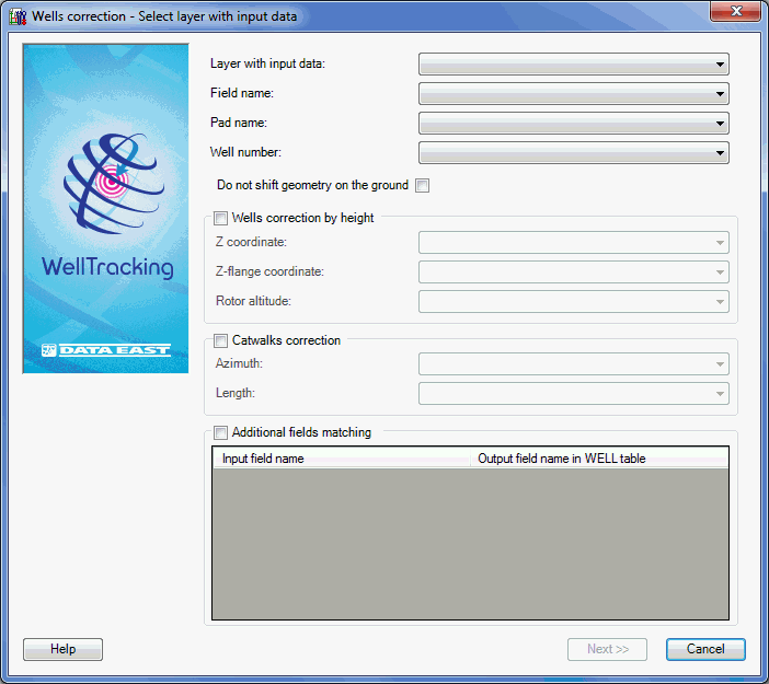
The mandatory fields are as following:
-
Layer with input data: the file with the field measurements. It can be either *.xls/*.xlsx table, shape file or geodatabase feature class containing real (not project) data about the wellhead coordinates of the drilled wells.
-
Field name: specify the field corresponding to the number of the appropriate Field in the field measurements file.
-
Pad name: specify the field corresponding to the number of the appropriate pad in the field measurements file.
-
Well number: specify the field corresponding to the number of the appropriate well in the field measurement file.
Wells correction by height condition allows adjusting well location by height and making changes in the flange and Earth coordinate values of the well attribute table.
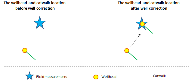
Catwalks correction condition allows changing catwalk length and its location relative to the well sequence line. If this condition is not specified, the catwalk with the wellhead will be moved to location corresponding to real drilled wellhead.
The Additional fields matching option allows transferring the values from the appropriate column of the field measurements table to the WELL attribute table. Note that the coincidence of the fields’ type in both tables is mandatory.
Click Next to move to the next step, or Cancel to exit the Wells correction tool dialog.
*****