


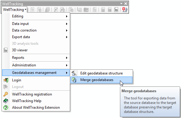
"Merge geodatabases" tool
The tool is provided for exchanging data between geodatabases with saving the target geodatabase structure. The tool can be run without the WellTracking system login.
Prior to start working with the tool, check the availability of the IDX index files in the feature classes. These indices are responsible for speeding up the table data processing, namely for searching the values accordance in the table fields.
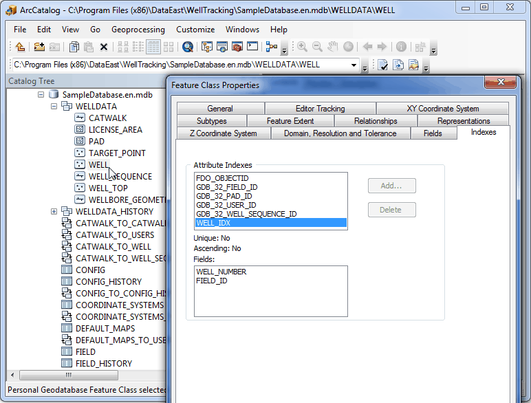
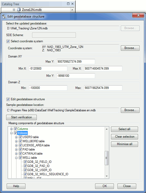
You can check the indices availability via ArcCatalog or with the Edit geodatabase structure tool. In the latter case upload the geodatabase participating in the geodatabase merge process to the dialog, check the box near the Edit geodatabase structure condition and start the verification. In case if you see Indexes section in the Missing components of geodatabase structure dialog, the structure of your geodatabase should be updated.
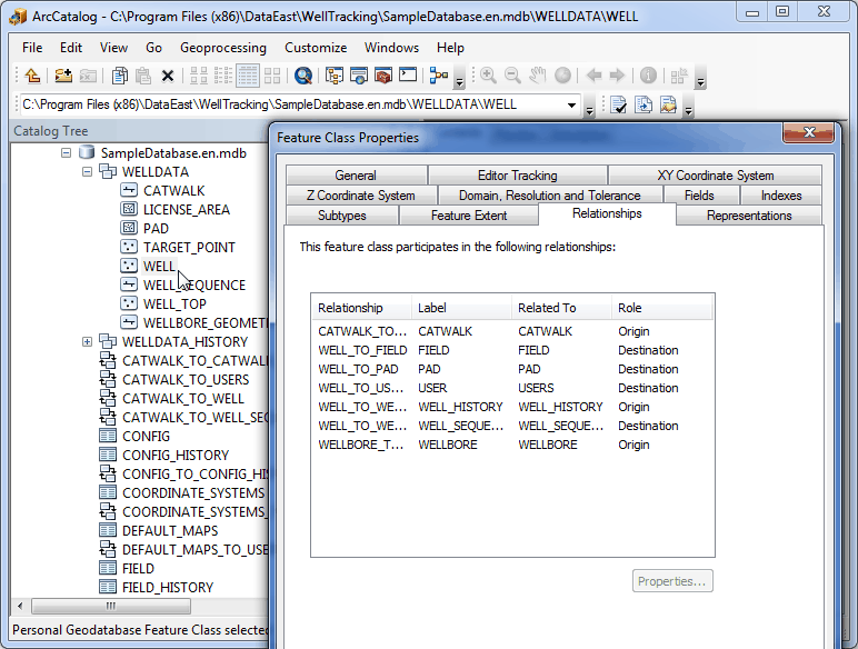
In such a way all geodatabases participating in the merge process should be updated. Since all WellTracking geodatabase objects are related to each other, the selected objects will have both parent and child objects. The two options of finding out which object is parent and which is the child object for your object are listed below.
1. Open the Relationships tab of the Feature Class Properties dialog to see the list of feature classes’ relationships. In terms of WellTracking Origin means the child object and Destination the parent object, correspondingly. So, the parent objects for the Well will be FIELD, PAD, USERS, and WELL_ROW, whereas the child objects will be WELLBORE and WELL_HISTORY.
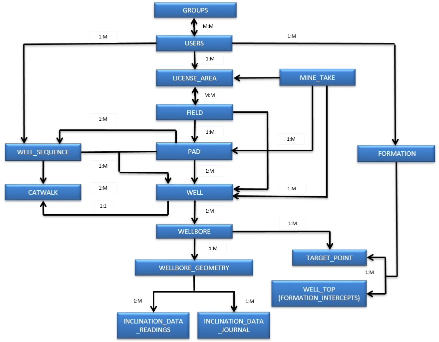
2. Analyze this WellTracking geodatabase schema fragment. For example, you need to transfer several wellbores of the WELL feature class to the target geodatabase. As per the scheme provided below the child objects of the WELL feature class will be WELLBORE, WELLBORE GEOMETRY, two inclination measurements tables, the related to wellbore WELL TOP and TARGET-POINT – these objects are located below WELL object on the scheme. The parent objects will be WELL_SEQUENCE, PAD, FIELD, LICENSE AREA, FORMATION, USERS – these objects locate above WELL object on the scheme.
Steps for merging geodatabases:
Step 1. Select features to merge;
Step 2. Specify fields for merging;
*****