


Step 3. Conflicts resolution
At this step you need to decide, which conflicts are critical for merging data and which ones can be skipped.
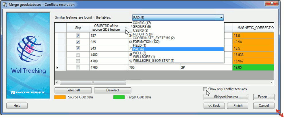
The dialog represents the list of tables containing similar objects with the number of matches shown in brackets. The dialog size can be changed for your convenience, if needed. The values in the OBJECTID fields can be sorted.
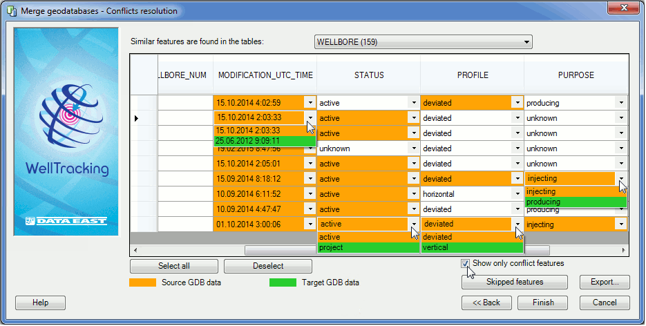
Check the box near the Show only conflict features option for your convenience in work with conflicts.
The table cells containing distinct values are marked with two colors: orange color indicates data from the source geodatabase, green color is for data from the target geodatabase. The user should specify those values that need to get to the target geodatabase after the geodatabases merge.
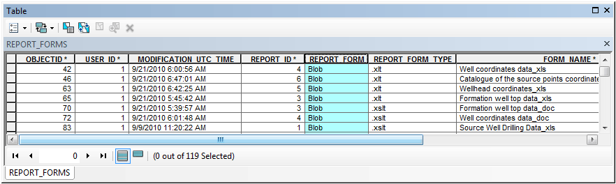
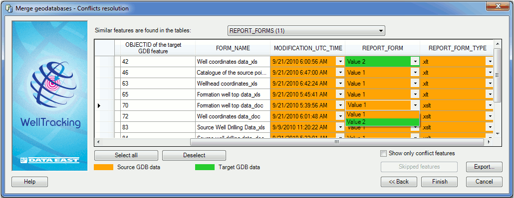
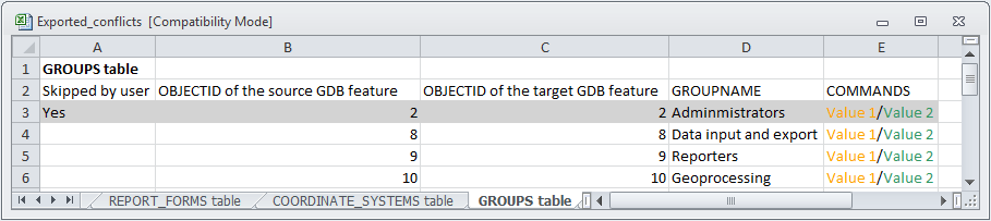
For tables with fields of Blob type the values in the conflicts tables’ cells will be specified as Value 1, Value 2 (see the REPORT_FORMS field of the REPORT_FORM table on the example below).
The Skip option allows excluding not only selected features from the list of features to copy, but also their related objects. For example, you have decided to exclude the pad from the list.
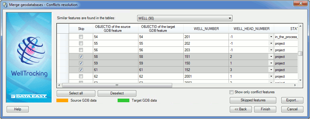
By doing this, all child features (such as wellrows, several wellbores, wellbore geometries, and etc.) related to this pad will be also skipped during the merge process. These skipped related features will be marked grey in the conflicts table and the correspondent boxes in the Skip column will be checked:
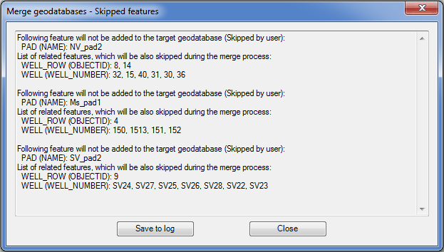
To review the list of all child features related to the conflict pad, press the Skipped features button to open the correspondent dialog. The list of skipped features can be saved in a log-file by pressing the Save to log button.
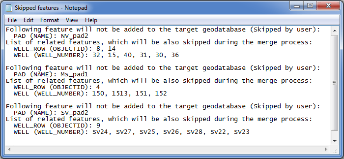
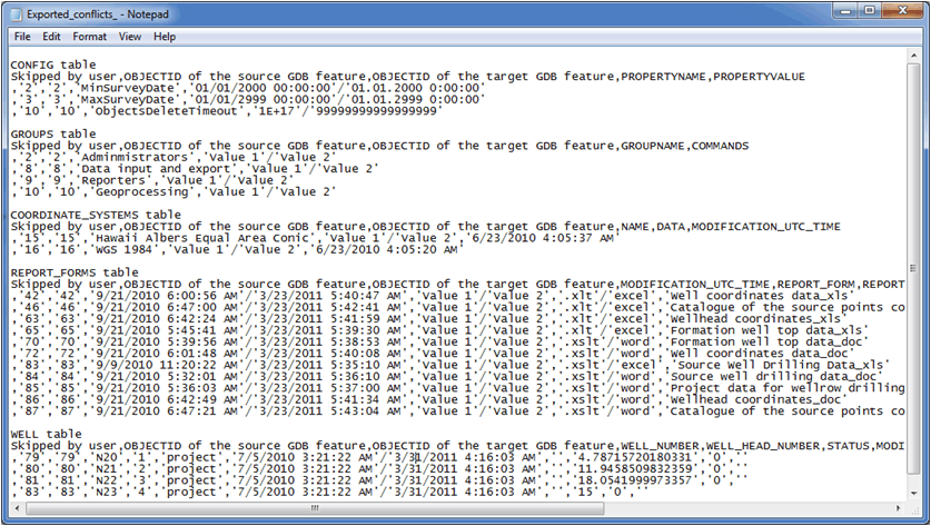
The saved log-file will look as following:
In case if no box is checked in the Skip field, the Skipped features button will be disabled.
Press Export… button to upload all conflicts variants to the *.csv and *.xls files. The examples of exported conflicts found during the data analyses before the geodatabases merging are shown below:
- In *.xls format:
- In *.csv format:
Press Finish button to run the process of merging data to the target geodatabase.
*****