


About WellTracking geoprocessing tools
The WellTracking geoprocessing tools are used the same as standard ArcGIS 10.x tools. They are intended for batch loading of table data to the database.
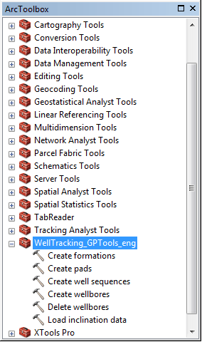
Following tools are provided in this group:
The access to each tool from the geoprocessing group is specified by System administrator (see Administrating. Users administration section).
To work with the geoprocessing tool table data in the *.xls, *.xslx, *.csv formats is required. See examples of files for processing in sections describing the work of the appropriate geoprocessing tools.
During files processing it is supposed that the first line contains the columns names, therefore it is skipped.
All coordinates should be specified in accordance with coordinate system of your geodatabase.
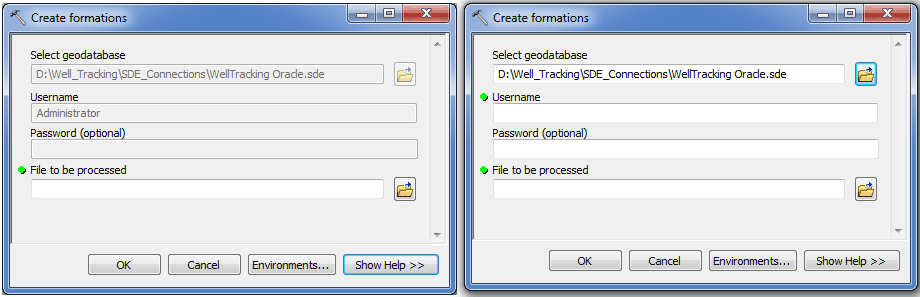
If you logged in the WellTracking system and are permitted to use geoprocessing tools, then it is not necessary to use password for working with them. If you did not log in, you will need to type both user name and password when running tools from ArcToolbox.
Adding of the geoprocessing tools is performed both in ArcMap and in ArcGIS via the ArcToolbox module (see Adding WellTracking geoprocessing tools for more details).
*****