Geoprocessing tools
The system allows using custom geoprocessing services to analyze and
search interactive map objects. The geoprocessing service settings allow
showing input and output service parameters in the interface of the interactive
map. The list of available services is displayed on the GP
Tools  tab.
tab.
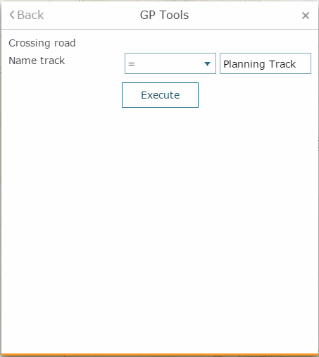
To start using geoprocessing tool, select it from the list. The tool parameters will be shown based on specified settings.
Input parameters can be as following:
-
Numbers and strings, dates. In general specify the equality operator, enter (or select from the drop-down list) the value used to compare your parameter, enter its value and measurement units.
-
Value from object. Select this tool to specify the object on the map, which attributes will be used for analysis.
-
Record set. Select this tool to add objects from the map.
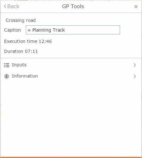
Press Execute to run the tool. The result will be shown on the map and in the results list of the GP Tool dialog.
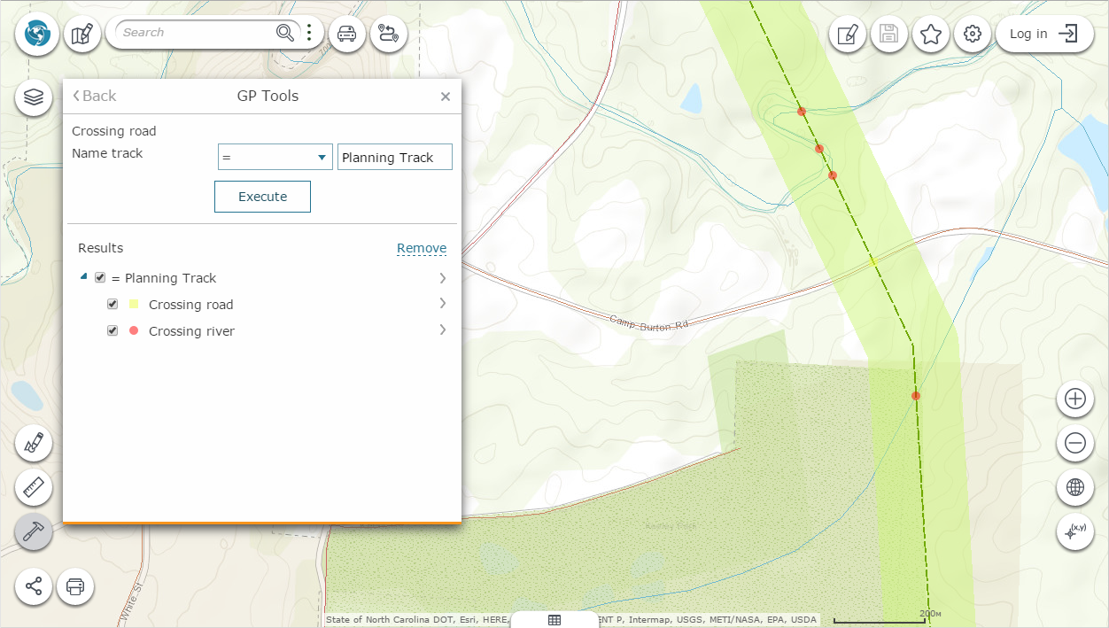
The context menu with the geoprocessing result contains the following options:
-
Open in attribute table
 - if the result
of geoprocessing is filtered map layer, its filtered attribute table
will be opened.
- if the result
of geoprocessing is filtered map layer, its filtered attribute table
will be opened. -
Change geoprocessing result color
 - the option for changing the geoprocessing result color is similar
to setting layer color option.
- the option for changing the geoprocessing result color is similar
to setting layer color option. -
Inputs - list of input parameters used for calculation by pressing Use parameters button
-
Information - list of system events taken place during analysis process.