


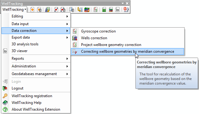
"Correcting wellbore geometries by meridian convergence" tool
The Correcting wellbore geometries by meridian convergence tool allows to rotate all wellbore geometries and all wellbores, excluding the project ones (geotypes: project, design-plan), with all formation intercepts data by the meridian convergence angle relative to the correspondent wellhead.
The tool is run from the Data correction menu:
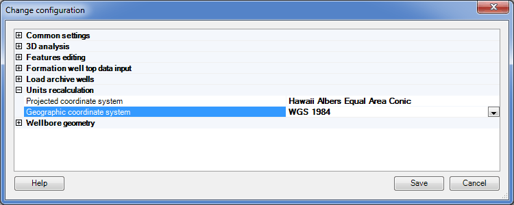
Prior to run the tool make sure the Units recalculation menu (the Administration section) is filled in to avoid correction errors.
The value of the meridian convergence angle is stored in the attribute table of the wellbore trajectories
WELLBORE_GEOMETRY in the field MERIDIAN_CONVERGENCE (type double). This field can be added manually using standard ArcMap operations, or with the Edit geodatabase structure tool.
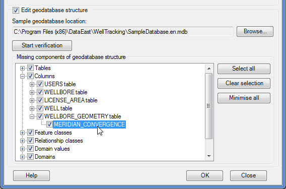
The tool updates only wellbores that have the empty value in the MERIDIAN_CONVERGENCE field.
The wellbore geometry correction is done in two following steps:
Step 1. Select wellbore geometries for correcting
*****