


Step 1. Select wellbore geometries for correcting
After your geodatabase structure has been updated, you can proceed to the wellbore geometries correction.
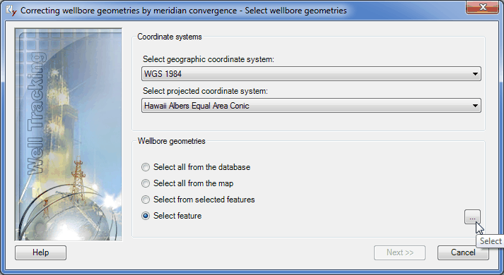
The coordinate systems selection is done automatically depending on the appropriate settings specified in the Change configuration > Units recalculation dialog. Note that this list is built in the Administration > Coordinate systems administration menu.
The following correction options are provided in WellTracking:
- Select all from the database – all wellbore geometries of your geodatabase (excluding the project ones) are updated at a time.
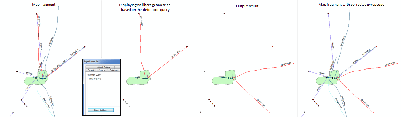
- Select all from the map option can be used when you need to show on your map only those wellbore geometries that meet the definition query settings (Layer properties definition query tab). If some of the wellbore geometries are not shown on the map, they will not be corrected.
- Select from selected features option allows to correct location of those wellbore geometries only that are selected on your map.
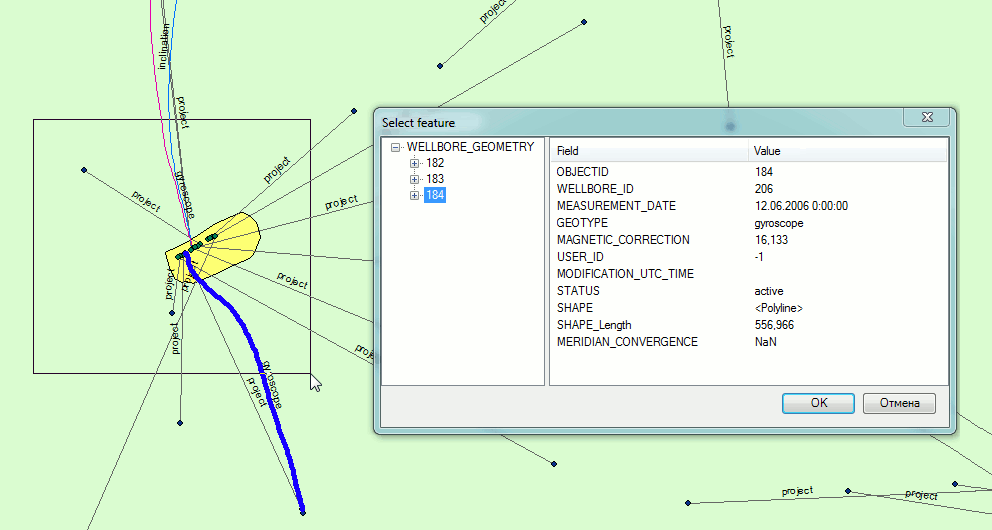
- Select feature option – press the Select button and point to the wellbore geometry you need to correct on map. Note that if you select several wellbore geometries with your mouse cursor, the Select feature dialog will appear. Select the required wellbore geometry from the list (it will be flashed on the map) in the dialog and press OK to close the Select feature dialog. The Finish button will be enabled in the tool dialog.
Select the required wellbore geometries and press OK to move to the final step.
*****