


Step 3. Change license area geometry
At this step user specifies the method of updating the feature's geometry.
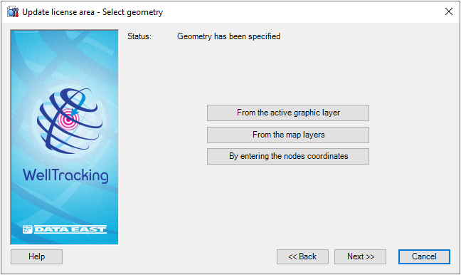
If you do not need any changes and the license area geometry remains the same, then its border on the map will be displayed in green. At that the Status show that the geometry has been specified.
WellTracking extension provides following methods of editing feature:
-
From the active graphic layer;
-
From the map layers;
-
By entering the nodes coordinates.
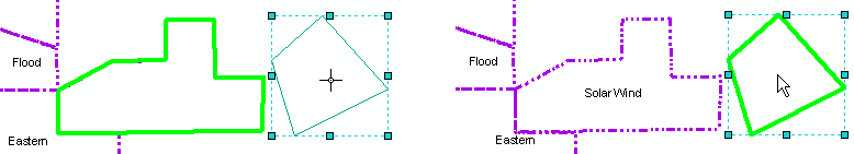
If you want to create the new geometry of the license area from the active graphic layer, select From the active graphic layer option.
Select the required graphic feature on the map using the cross hair
cursor ( ) so that its border is displayed
in green.
) so that its border is displayed
in green.
The Status line will change to "Geometry has been specified" and the Next button will become active.
-
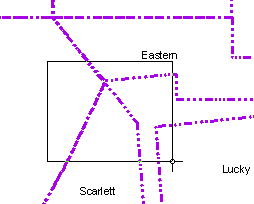
If the feature geometry locates in one of the polygon layers on the map ( shape-file or feature class of another database having the same projection as the WellTracking database does ), press From the map layers button and point to the required feature in ArcMap using the cross hair cursor (
), so that this feature's
border becomes green. You can change the cursor to a frame to select
the group of areas simultaneously, if required.
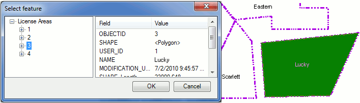
Attribute data of features found in the frame will be displayed in the "Select feature" table. The License area selected in the "Feature class" column can be highlighted on the map. Press ОК.
The Status line will change to "Geometry has been specified", and the Next button will become active.
-
The Enter nodes coordinates option allows to change the polygon shape by changing the nodes order, number (adding the new/delete the old nodes), as well as by entering the additional parts in cases when the updated license area consists of several objects.
The Use map spatial reference option is provided to enter map coordinates, which can differ from the database coordinates. If this option is not checked the feature coordinates will be automatically projected to the database coordinates.
If you run this tool you will see that the Enter nodes coordinates dialog is already filled with the XY nodes coordinates of the selected area. You will just need to edit the existent values and enter the new ones.
Press the  - Add
part button of the Parts dialog to specify the coordinates of the
new part of the license area. Fill in the appeared dialog with the coordinates
of the new polygon. The order of the nodes (records in the table) is managed
with the - Add
node,
- Add
part button of the Parts dialog to specify the coordinates of the
new part of the license area. Fill in the appeared dialog with the coordinates
of the new polygon. The order of the nodes (records in the table) is managed
with the - Add
node,  - Delete
node,
- Delete
node,  - Move
up,
- Move
up,  - Move
down buttons, in the lower part of the Nodes dialog. Press
the Preview button to view the
geometry of the updated object.
- Move
down buttons, in the lower part of the Nodes dialog. Press
the Preview button to view the
geometry of the updated object.
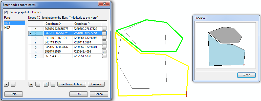
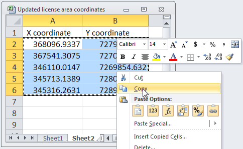
The Load from clipboard option is provided for loading the nodes coordinates from the .xls tables. To do this create the table with nodes XY coordinates and copy the values to the clipboard.
Hot keys:
CTRL+N - add the new node;
CTRL+C - copy value;
CTRL+V - paste the copied value;
CTRL+UP - move up several table records;
CTRL+DOWN - move down several table records.
In the Preview dialog you can view the geometry of the updated Polar star license area.
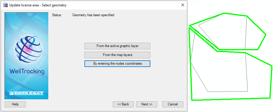
Press OK in the Enter nodes coordinates dialog if you finished editing the nodes coordinates and adding the new parts to update the license area. The Status line of the dialog will become active and indicate that "Geometry has been specified".
The expected border of the updated license area will be marked on the map with green color.
Press Back to get back to the previous step, press Next to move to the next step and Cancel to exit the Update license area dialog.
*****