


"Distance between nodes" tool
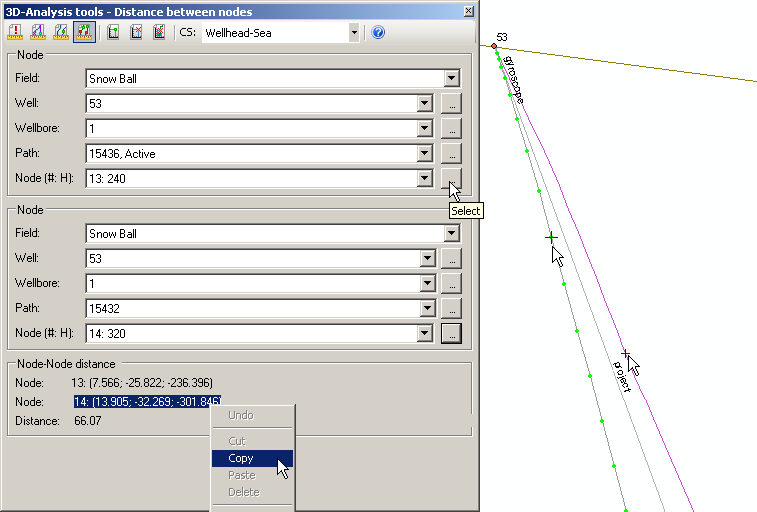
The tool is provided for calculating the distance between selected nodes of two wellbores.
-
Select the required coordinate system, which units will be used to create the result.
-
Specify the node parameters. To do this specify the required path (from the list or on the map with the cursor). The selected polyline will be marked with the green nodes. The Path text-box contains the OBJECTID of the path specified in the WELLBORE_GEOMETRY table and its status. The drop-down list of the Node (#,H) will contain the numbers of the nodes and depths of the nodes along wellbore. The required node can be selected from this list or by clicking the node on the map. The selected node will be marked with the cross symbol.
-
The X, Y coordinates of nodes in the resulting table will be specified based on the mathematic model: X-Longitude East, Y-Latitude North. Z coordinate corresponds to the absolute depth value.
-
All nodes coordinates can be copied to clipboard and further pasted to Notepad or Word and Excel applications.
*****