


"Coordinates of nearest node" tool
Select the Coordinates of nearest node tool in the 3D analysis tools toolbar.
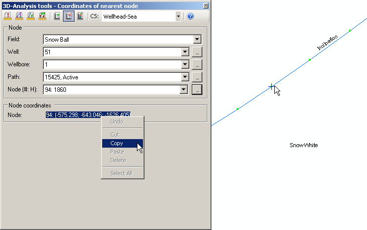
Select the required coordinate system from the drop-down list of the CS text-box. The units of the selected coordinate system will be used for the output coordinates of the nearest node of the wellbore. However, if you select incorrect coordinate system, the output node coordinates will be shown as "empty geometry".
![]()
-
Specify the node parameters. To do this select the required wellbore path from the appropriate list or click on the required polyline on the map. The green nodes will be shown on the selected polyline. The Path text-box contains the OBJECTID of the path specified in the WELLBORE_GEOMETRY table and its status. The list of nodes of the specified path will be shown automatically. The Node (#, H) text-box contains the number of the node and the depths of the node along wellbore. The required node can be selected from the list of nodes of the specified path or from the map by clicking on the required node. The selected node will be marked with the small cross symbol.
The X, Y coordinates are specified based on the mathematic model: X-Longitude East, Y-Latitude North. Z coordinate corresponds to the absolute depth value.
All nodes coordinates can be copied to clipboard and then opened in Notepad, Word or Excel applications.
*****