


"Paths divergence" tool
This tool is aimed at estimating the proximity of the adjacent wellbores.
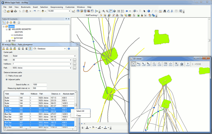
To start working with this tool the following mandatory parameters should be specified:
- System coordinate, which units will be used to define the distance between the wellbores paths
- Parameters of the Center path (the path to be analyzed and which parameters will be used to perform calculations). Select the path from the list or click on the required polyline on the map. The selected path will be marked green. The OBJECTID of the path taken from the WELLBORE_GEOMETRY table and its status will be shown in the appeared Path information dialog.
- Select the condition used to calculate the distance to the adjacent wellbore or wellbores located in the buffer zone created around the center path.
The adjacent wellbores are defined based on the specified buffer zone parameters. They will be marked orange on the map and in the 3D viewer dialog.
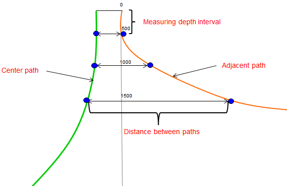
The distance between paths is calculated based on the specified vertical measuring depth interval.
The table with rows showing the points on the path on the map or in the 3D viewer will be prepared as the result. The table columns can be sorted, if required.
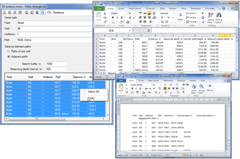
The selected rows can be copied and pasted to MS Excel table or text file.
*****