


Step 5. Specify report file name and location
In the next dialog specify the path to the file, where the report will be saved.
Сheck the box near the Open file when finished option to view the report data just after the work of the tool is completed.
Click Finish to initiate the report creation.
Click Cancel to close the Create report tool dialog.
Below are the reports, created as a result of the tool work.
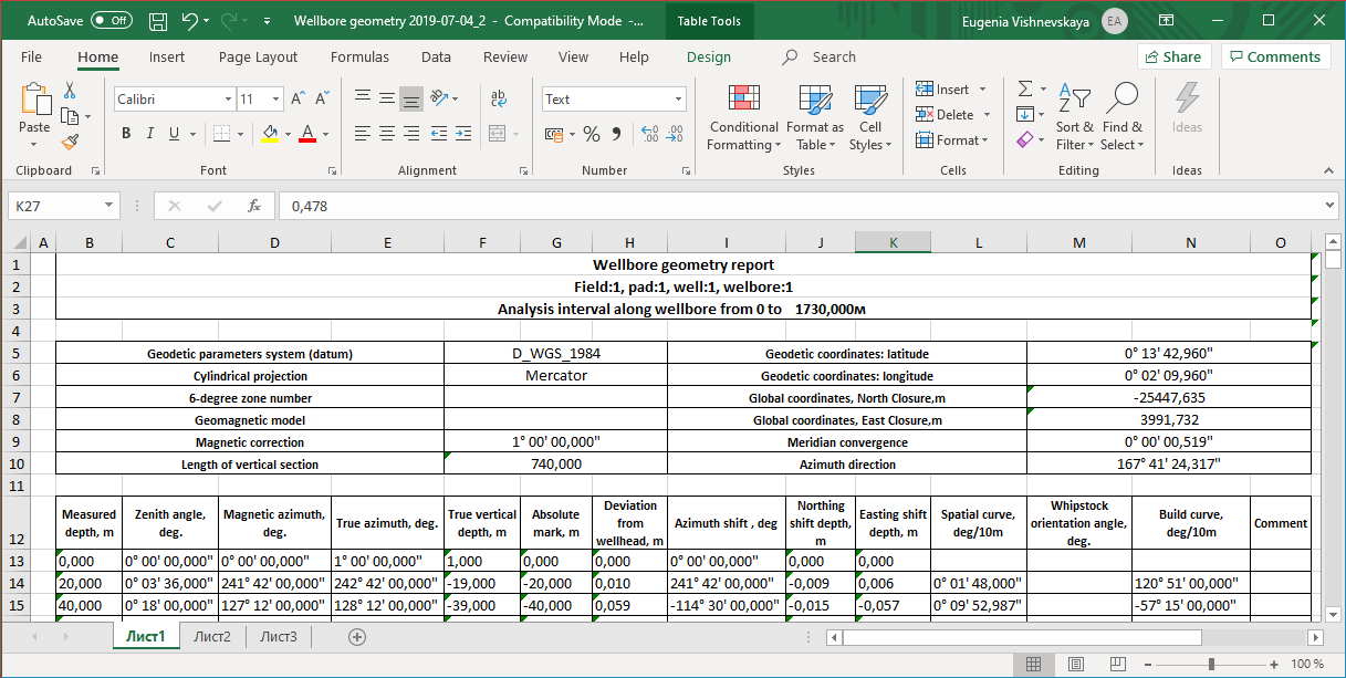
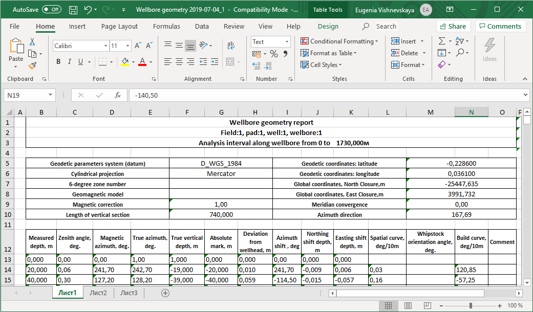
In this report:
- True azimuth – magnetic azimuth plus magnetic correction.
- Absolute elevation mark – vertical depths minus wellhead altitude.
- Wellhead deviation:
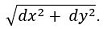
- Offset azimuth – current azimuth minus previous azimuth.
- Spatial intensity: arccos(cos(inc[i+1])*cos(inc[i]) + sin(inc[i+1])*sin(inc[i])*cos(az[i+1]-az[i])), where inc – zenith angle, az – azimuth.
*****