


Step 3. Select wellbore geometry
At this step select the field, the well and the path from the appropriate lists.
Select
the required field from the list of your database fields. You can also
press Select button and click
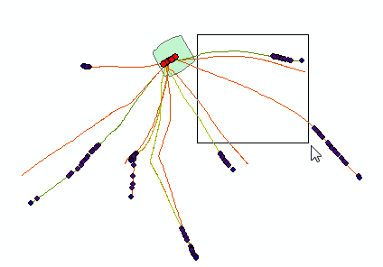
on the required pad area with the well sequence on the map with the cross
hair cursor  . The cursor can
be changed to the frame to select an area with several features, if required.
All features, including those partially captured by the frame, are displayed
in the list of the attribute table Select
feature. The attributes of the PAD and FIELD tables are related,
so the field name of the selected pad area will be automatically added
to the dialog.
. The cursor can
be changed to the frame to select an area with several features, if required.
All features, including those partially captured by the frame, are displayed
in the list of the attribute table Select
feature. The attributes of the PAD and FIELD tables are related,
so the field name of the selected pad area will be automatically added
to the dialog.
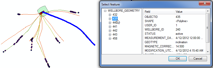
The well, the wellbore and the path can be selected either from the lists or on the map.
All paths, including those partially captured by the frame, are displayed in the feature classes list of the attribute table Select feature. If you select one of the OBJECTID features in the list, it will be highlighted on the map and its attributes will be displayed in the Fields dialog. Select the required feature from the list and press OK.
Click Next to continue report creation.
Click Cancel to close the tool dialog.
*****