


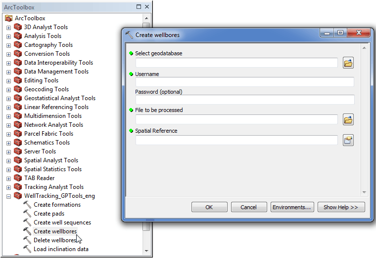
Geoprocessing tool "Create wellbores"
In order to create wellbores in the database based on the table data, the following dialog should be filled in.
-
Select the geodatabase. By default the path to the active GDB used for the last entrance will be specified. If you are logged in the WellTracking system, the path to the database is specified automatically.
-
Specify user name;
-
Enter password (optional parameter);
-
Specify the file name and location
-
Specify the input data Spatial Reference.
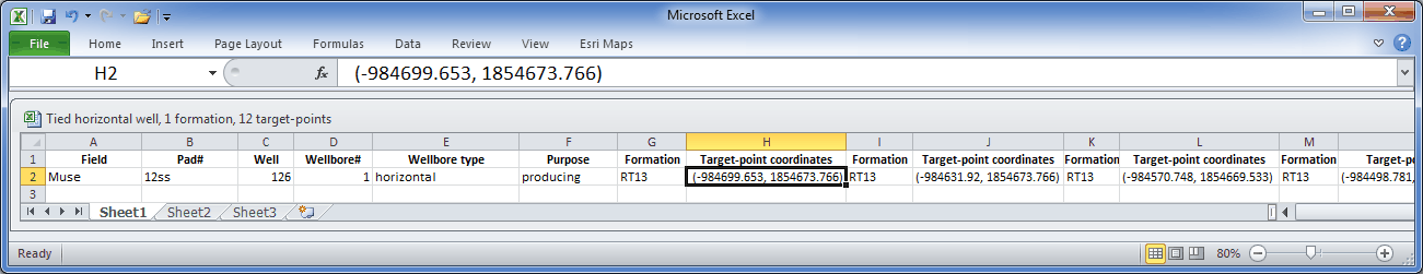
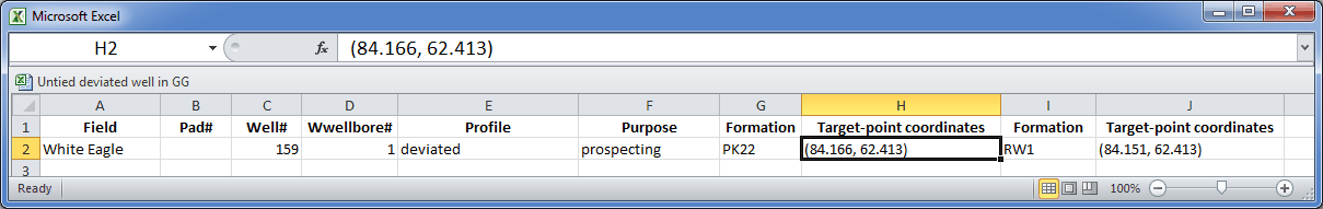
Examples of the text file in the *.xlsx format with the wellbores parameters to be added to the database using the "Create wellbores" geoprocessing tool.
Example 1. Creating the tied horizontal wellbore with multiple target-points located in one formation.
Example 2. Creating untied deviated wellbore with two target-points located in different formations. Since the geodatabase is in geographic coordinate system, the target-points coordinates are specified in decimal degrees.
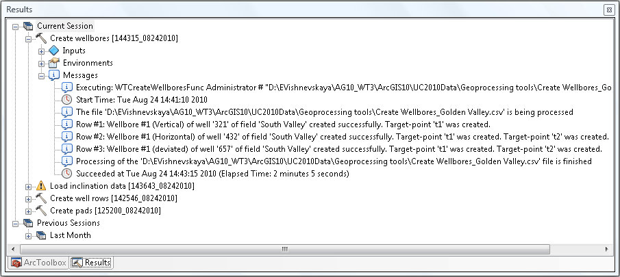
Press ОК to run the project wellbore creation process. The list of found errors will be shown in the process status dialog.
*****