


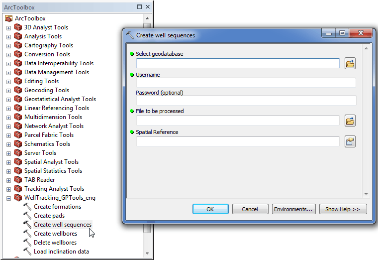
Geoprocessing tool "Create well sequences"
In order to add text data about well sequences to the database, following dialog should be filled in.
-
-
Select the geodatabase. By default the path to the active GDB used for the last entrance will be specified. If you are logged in the WellTracking system, the path to the database is specified automatically.
-
Specify user name;
-
Enter password (optional parameter);
-
Specify the file name and location;
-
Specify the input data Spatial Reference.
-
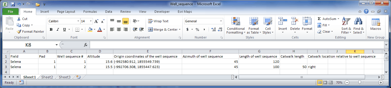
Example of the text file in the *.xslx format with the well sequence parameters to be loaded to the database using the "Create well sequences" geoprocessing tool.
The file should contain following fields:
- Field;
- Pad;
- Well sequence number;
- Altitude;
- Origin coordinates of the well sequence;
- Azimuth of well sequence;
- Length of well sequence;
- Catwalk length - optional parameter;
- Catwalk location relative to well sequence - optional parameter.
Note that for catwalks the Catwalk length and Catwalk location relative to well sequence parameters are necessary, otherwise catwalk will not be created.
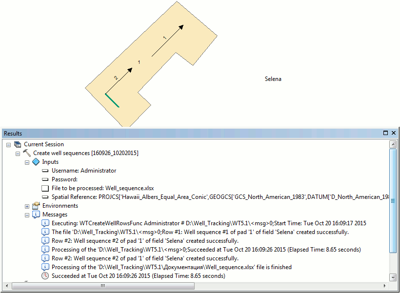
Press ОК to run the project well sequence creation process. The list of found errors will be shown in the process status dialog.
******