


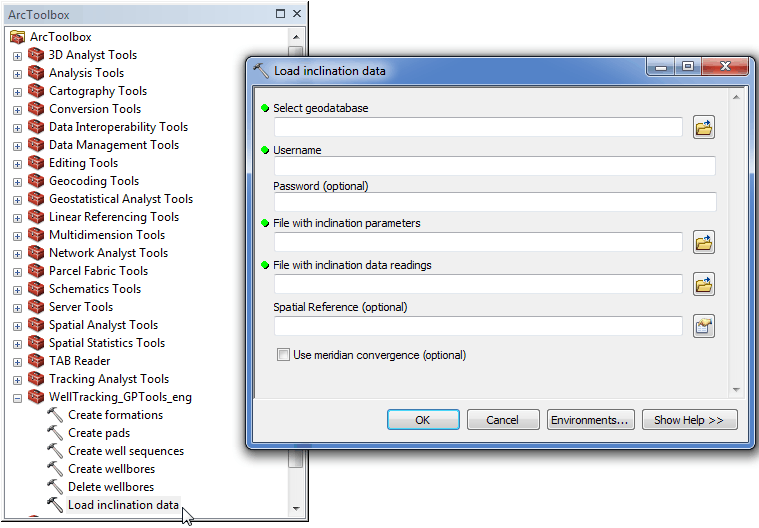
Geoprocessing tool "Load inclination data"
In order to add text inclination data to the database, following dialog should be filled in.
-
Select the geodatabase. By default the path to the active GDB used for the last entrance will be specified. If you are logged in the WellTracking system, the path to the database is specified automatically.
-
Specify user name;
-
Enter password (optional parameter);
-
Specify the inclination data file name and location;
-
Specify the name of the file with the inclination data readings;
-
Specify the input data Spatial Reference;
-
Check up the Use meridian convergence condition if necessary.
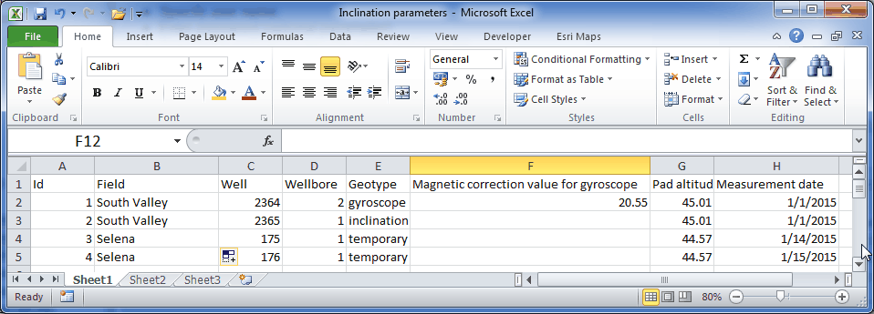
Example of the table file in the *.xlsx format with the inclination data parameters to be loaded to the database using the "Load inclination data" geoprocessing tool.
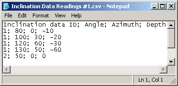
Example of the file with inclination reference points in the *.csv format, used for work of the "Load inclination data" geoprocessing tool.
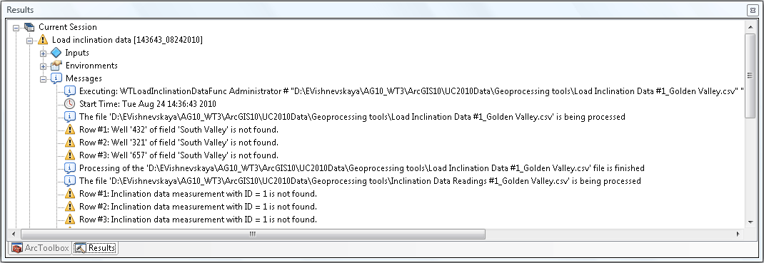
Click ОК to run the inclination data loading process. The list of found errors will be shown in the process status dialog.
*****