


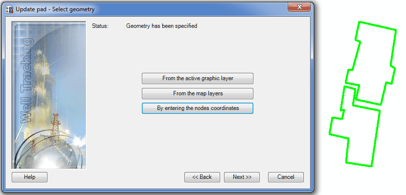
Step 4. Update pad geometry
At this step you change the feature's geometry. If you do not need to change the existent geometry, press Next to move to the next step.
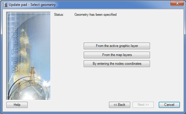
WellTracking extension provides following methods of editing field:
-
From the active graphic layer;
-
From the map layers;
-
By entering the nodes coordinates.
If you want to create the new geometry of the pad from the active graphic layer, select From the active graphic layer option.
Select the required graphic feature on the map using the cross hair
cursor ( ).
).
The Status line will change to "Geometry has been specified".
If the feature's geometry locates in one of the polygon layers on the
map (shape-file or feature class of another database having the
same projection as the WellTracking database does) press From
the map layers button and point to the required feature in ArcMap
using the cross hair cursor (). You can
change the cursor to a frame to select the group of pads simultaneously,
if required.
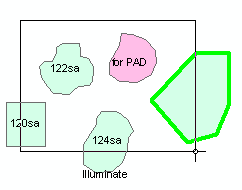
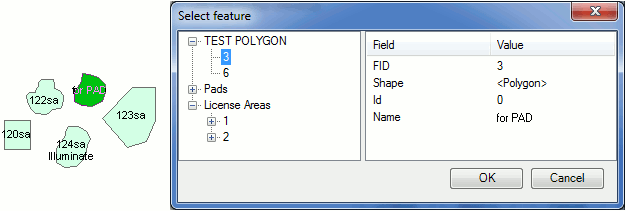
Attribute data of features found in the frame will be displayed in the Select feature table. The pad selected in the Feature class column can be highlighted on the map.
The Status line will change to "Geometry has been specified".
-
The Enter nodes coordinates tool allows for changing the polygon shape by changing the nodes order, number (adding the new/delete the old nodes), as well as by entering the additional parts in cases when the updated pad consists of several objects.
The entering of the nodes coordinates is done in the Enter nodes coordinates dialog.
The Use map spatial reference option is provided to enter map coordinates, which can differ from the database coordinates. If this option is not checked the feature coordinates will be automatically projected to the database coordinates.
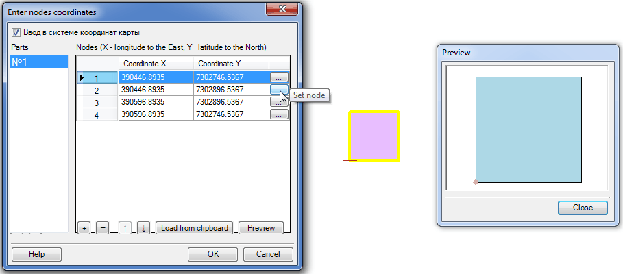
During the first activation of the dialog the nodes coordinates of Part
#1 will be added automatically. The order of the table records (pad area
nodes) is managed with the  - Add node,
  - Delete node,
  - Move up,
  -
Move down buttons. The nodes coordinates
values are edited manually or using the menu activated by right-clicking
the mouse button.
-
Move down buttons. The nodes coordinates
values are edited manually or using the menu activated by right-clicking
the mouse button.
The Set node button allows entering the node coordinates with the mouse click and so sequentially constructing the required feature.
The Preview dialog is provided to view the shape of the updated pad area.
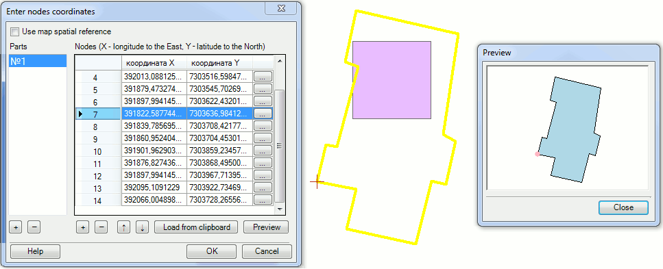
The nodes coordinates can be added manually or using the Load from clipboard button.
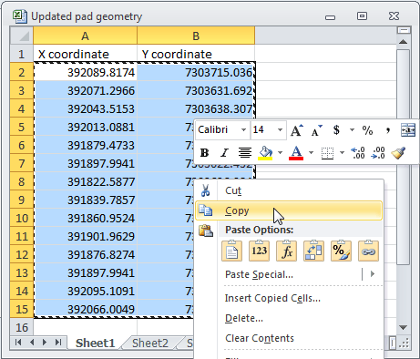
Select and copy the nodes coordinates to the clipboard and then press the Load from clipboard button. The copied data will be added to the dialog. Open the Preview dialog to view the geometry of the updated pad area.
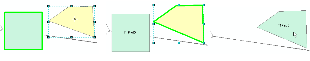
In the sample the nodes coordinates of the project pad area (square) have been deleted and then the actual coordinates obtained after the pad area construction have been added from the clipboard.
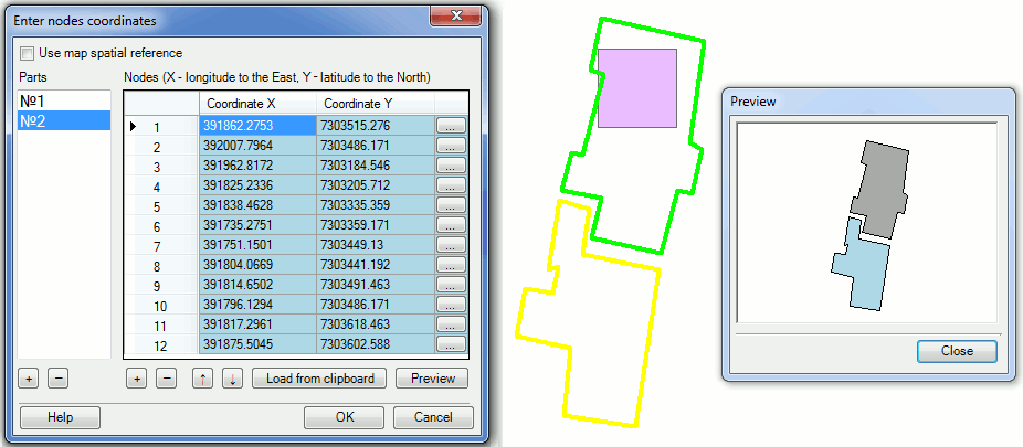
If the updated pad consists of several parts, you can add the rest of the polygons by pressing the Add part button in the lower part of the Parts dialog. By default the coordinates for Part#1 are added. If you need to add Part#2 of the polygon, press the Add part button and enter the coordinates for polygon 2 in the appeared dialog. The active part of the Parts dialog is always marked blue.
If your pad area consists of several parts, the pad geometry of the already created part will be shown green on the map, whereas the newly created part will be yellow.
Hot keys:
CTRL+N - add the new node;
CTRL+C - copy value;
CTRL+V - paste the copied value;
CTRL+UP - move up several table records;
CTRL+DOWN - move down several table records.
Press OK to close the Enter nodes coordinates dialog and the geometry of the updated pad area will be shown green on the map.
Click Back to get back to the step of specifying the pad properties and Cancel to exit the Update pad tool dialog.
*****