


How to work with MS Excel tables using Wells correction tool
ArcMap allows visualising table or text data with X,Y coordinates as points and also exporting this set of points to the ArcGIS data format.
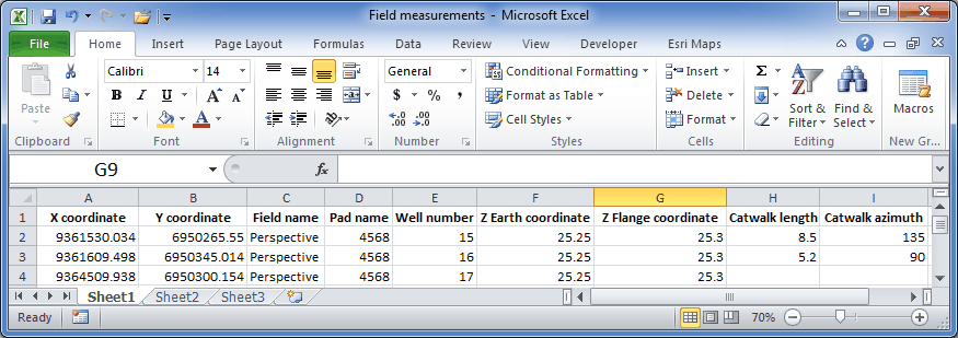
If you have field data as *.xls/xlsx tables and want to convert them to a layer to further work with it in WellTracking, following preparatory work should be made:
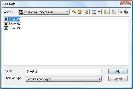
1. Add your *.xls/xlsx table to the project. Click Add
Data  button on the
ArcMap toolbar. In the opened Add Data dialog find the Field measurements
table, select Sheet1$ and press Add.
button on the
ArcMap toolbar. In the opened Add Data dialog find the Field measurements
table, select Sheet1$ and press Add.
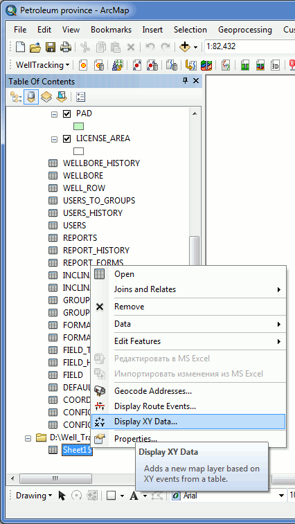
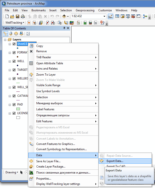
2. Click on the List By Source button in the upper part of the ArcMap Table Of Contents and
select Sheet1$. Right click to open the table menu and select Display XY Data.... option.
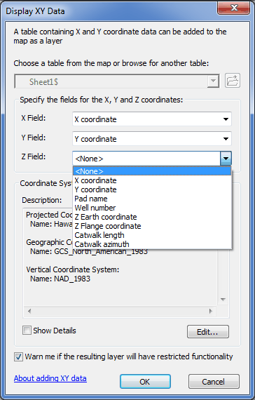
3. Fill in the Display XY Data... dialog. From the list of the *.xls table fields select those corresponding the X and Y fields. Click OK. Note that ArcMap supports mathematic geoid model only, i.e. X - Longitude East, Y - Latitude North.
4. Close Display XY Data... dialog. A new point layer with the name of your table will be added to the table of content. This layer is virtual (Events layer) and it is not placed on your hard drive. However the WellTracking Wells correction tool can work with this layer.
You can export this virtual field measurements layer to any of the ArcGIS formats and use in your further work, if required.
*****