


Converting TAB files to ArcGIS (multiple)
The TAB to ArcGIS (multiple) tool is provided for batch conversion of multiple TAB and MIF/MID files to ArcGIS geodatabase. At that, it is allowed to save symbology as representations and also create layer files for the converted feature classes.
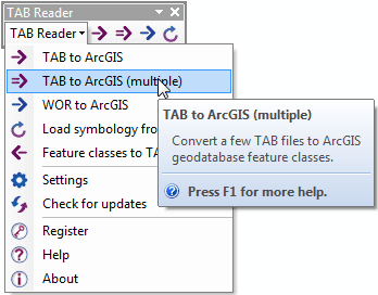
The tool is equally available from the TAB Reader toolbar in both ArcMap and ArcCatalog:
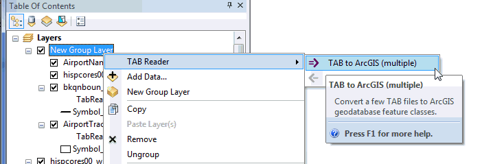
Besides, the tool is available from the TAB file context menu in the Table of contents in ArcMap:
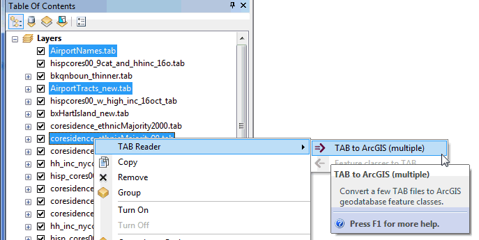
Or from the TAB file context menu in ArcCatalog (Catalog):
In the tool dialog you can specify multiple input TAB files as well as output geodatabase and layer file:
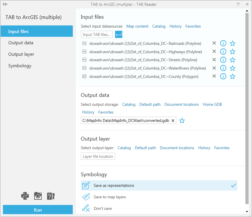
Selecting input TAB files.
Input TAB files are the files that will be converted to the selected ArcGIS geodatabase. Interchange MIF/MID files can also be selected and converted.
Input TAB files can be selected in a few ways:
-
From the Map content
- This option is available and can be used if you have the required TAB files added in ArcMap. The option is not available for the empty map or if you use the tool from ArcCatalog.
-
From Catalog
- There is no ArcGIS Catalog option provided for TAB files so you can simply select the required TAB files from a local disk or connected network drives, no matter if the folders are connected.
-
From History
- This option can be used if you have recently worked with the required TAB files and have them saved in History.
-
From Favorites
- This option can be used if you have the required TAB files saved as Favorite.
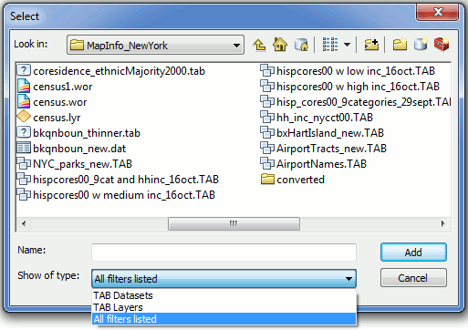
Selecting input TAB files from Catalog:
Specifying output data.
Converted output data can be specified using following options:
-
Using Catalog
- Here you can specify the output geodatabase using the connected folders in Catalog.
-
Using Default path
- This option allows to restore the default path where the output file geodatabase will be created in the same folder with the input TAB files.
-
Document locations
- With this option you can select between the current map document location or map datasets locations.
-
Home GDB
- This option allows to output data to the default geodatabase.
-
From History
- This option can be used if you have recently worked with the required geodatabase and have it saved in History.
-
From Favorites
- This option can be used if you have the required geodatabase saved as Favorite.
Specifying output layer file.
Converted output data can be accompanied with the group layer file, this can be specified using following options:
-
From disk
-This option allows to specify the output map/layer file on disk.
-
Default path
- This option allows to restore the default path where the output map/layer file will be saved in the same folder with the input TAB file.
-
Document locations
-This option allows selecting output path from the current map document or datasets locations.
-
From History
- This option can be used if you have recently worked with the required map/layer file and have it saved in History.
-
From Favorites
- This option can be used if you have the required map/layer file saved as Favorite.
Creating output layer file is optional and layer file can be left blank if not required.
Having set all parameters press the Run button to convert multiple selected TAB files to ArcGIS.