


Converting TAB files to ArcGIS
The TAB to ArcGIS tool allows converting MapInfo TAB and MIF/MID files to ArcGIS geodatabase feature classes. At that, it is allowed to save symbology as representations or as map layers and also create accompanying layer files for the converted feature classes.
The tool is equally available from the TAB Reader toolbar in both ArcMap and ArcCatalog. Besides, the tool is available from the TAB file context menu in the Table of contents in ArcMap or from the TAB file context menu in ArcCatalog (Catalog).
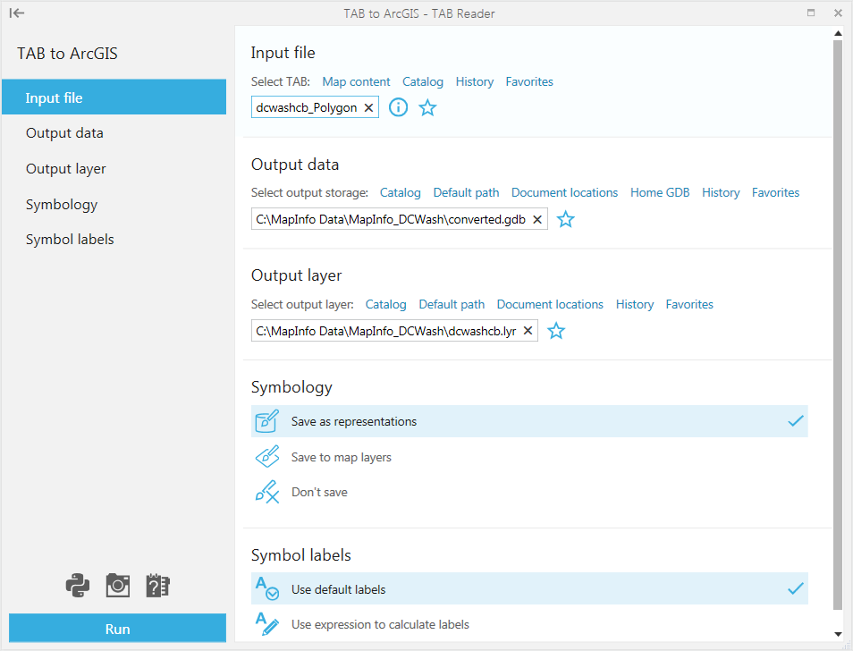
Selecting input TAB file.
Input TAB file is the file that will be converted to the selected ArcGIS geodatabase. Interchange MIF/MID files can also be selected and converted.
Input TAB file can be selected in a few ways:
-
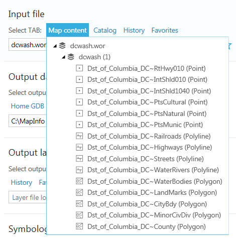
From Map content
- This option is available and can be used if you have the required TAB file added in ArcMap. The option is not available for the empty map or if you use the tool from ArcCatalog.
Converting TAB file added from the map content you can select to convert only selected features, if there are any selected features in the TAB file.
-
From Catalog
- This option allows adding TAB files from disk using Catalog like any other ArcGIS datsets.
-
From History
- This option can be used if you have recently worked with the required TAB file and have it saved in History.
-
From Favorites
- This option can be used if you have the required TAB file saved as Favorite.
Example of selecting input TAB file from Map content:
Specifying output data.
Converted output data can be specified using following options:
-
Using Catalog
- Here you can specify the output geodatabase using the connected folders in Catalog.
-
Using Default path
- This option allows to restore the default path where the output geodatabase will be created in the same folder with the input TAB file.
-
Document locations
- With this option you can select between the current map document location or map datasets locations.
-
Home GDB
- This option allows to output data to the default Home geodatabase.
-
From History
- This option can be used if you have recently worked with the required geodatabase and have it saved in History.
-
From Favorites
- This option can be used if you have the required geodatabase saved as Favorite.
Specifying output layer file.
Converted output data can be accompanied with the layer file, this can be specified using following options:
-
Using Catalog
- Here you can specify the output map/layer file on disk.
-
Using Default path
- This option allows to restore the default path where the output map/layer file will be saved in the same folder with the input TAB file.
-
Document locations
- With this option you can select between the current map document location or map datasets locations.
-
From History
- This option can be used if you have recently worked with the required map/layer file and have it saved in History.
-
From Favorites
- This option can be used if you have the required map/layer file saved as Favorite.
Creating layer file is optional and may be skipped.
Saving symbology.
Following options are available for saving symbology:
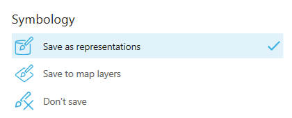
-
Save as representations
- Symbology from the input TAB file will be saved as representation for the converted geodatabase feature class.
Please note, this option is unavailable with ArcGIS Basic license.
-
Save to map layers
- Symbology from the input TAB file will be saved to map layer if output feature class is added to map.
-
Don't save
- Symbology won't be saved.
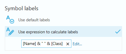
Specifying symbol labels.
There are two options provided for the symbol labels:
-
Use default labels
- Select this option to default simple legend labels like Symbol_1, Symbol_2, etc.
-
Use expression to calculate labels
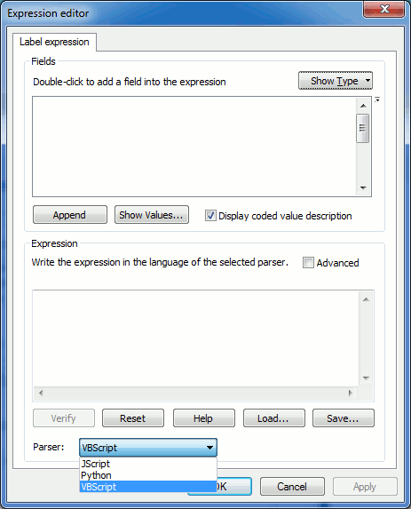
- Select this option to calculate more advanced labels combining multiple fields using expressions. Expressions can be written in one of the supported languages. Standard parsers available in ArcGIS are supported - JScipt, Python, VBScript.
Example of the label expression:
Expressions can be defined using the standard Expression editor dialog in ArcGIS:
Having set all parameters press the Run button to convert TAB file to ArcGIS. Processing status is displayed showing the steps and overall progress.
Successful processing is confirmed by the corresponding message indicating the processing time.